
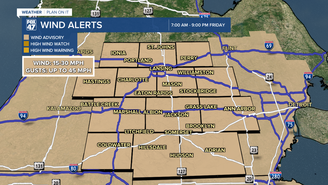
WIND ADVISORY in effect from 7:00 AM until 9:00 PM Friday. Sustained winds at 15-30 mph are expected with gusts up to 45 mph. Downed tree limbs and isolated power outages are possible.
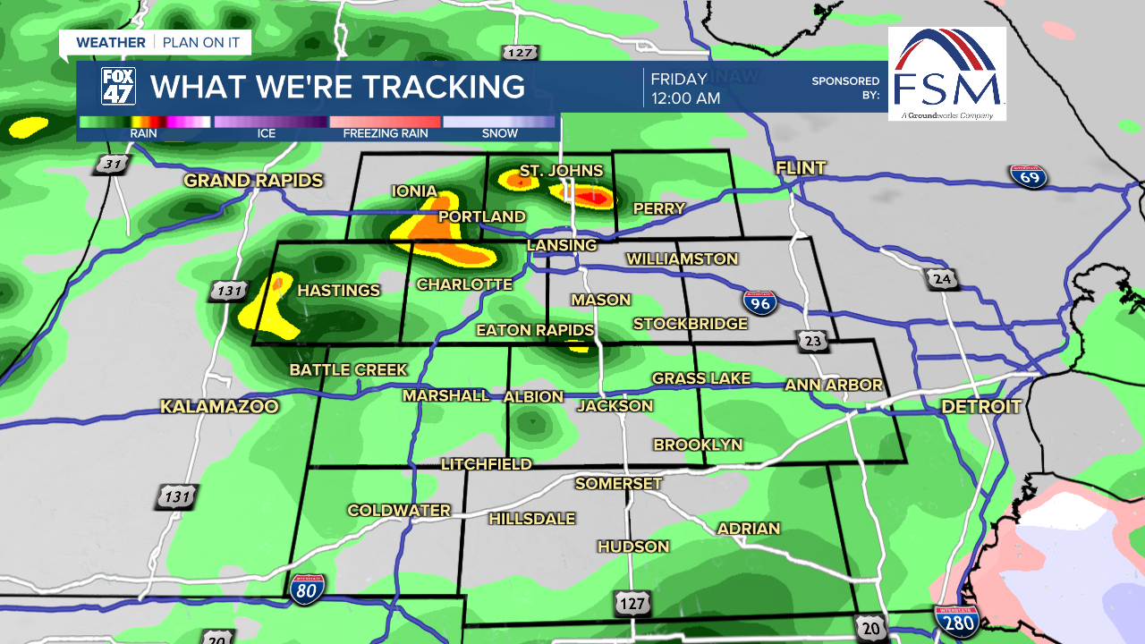
More showers are on the way tonight as an area of low pressure track toward the Great Lakes. Occasional heavy downpours are possible along with a few rumbles of thunder. Temperatures will settle toward the low 40s, with ESE winds picking up to 5-15 mph.
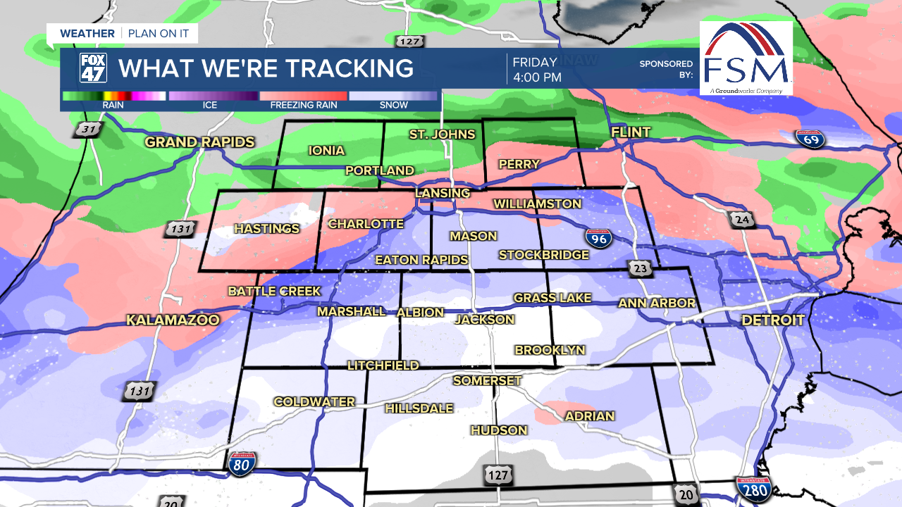
Low pressure tracks directly across the state on Friday morning, starting the day with some additional rain showers and a sharp increase in winds. Temperatures will start in the low to mid 40s, then gradually fall into the 30s throughout the afternoon. This will lead to mixed rain and snow showers that will carry us into the first part of Friday evening. In addition to slick road conditions, use extra caution due to the expected strong winds.
GET YOUR FOX 47 FORECAST HERE
A few snow showers early Friday evening will give way to mostly cloudy skies overnight. Breezy conditions will remain in place as lows dip to the low 30s. This will set the stage for temperatures more typical of late-February this weekend. Highs will hover in the mid 30s throughout the weekend, with a few flurries on Saturday giving way to more widespread snow showers and a new disturbance on Sunday.
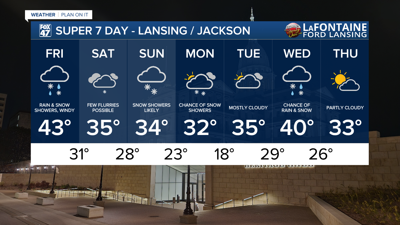
Highs in the 30s have the run of things for most of next week. A few more snow showers will be possible on Monday, followed by a break on Tuesday. Wednesday sees a small bump up to a high of 40 with the chance for rain and snow, then back to the low 30s on Thursday with partly cloudy skies.
Want more FOX 47 News? Here's how you download our Roku app
You can also see the latest news from across our mid-Michigan neighborhoods by liking us on Facebook or following us on X.
