


LANSING, Mich. — Overnight showers and isolated thunderstorms continue to move across our neighborhoods. Temperatures reach an overnight low of 64°F, with winds out of the NE at 11mph, but gusting in the low 20s at times. Showers continue into Sunday morning.
After a soggy start to Sunday, Mid-Michigan will enjoy a stretch of pleasant summer weather to begin the workweek before an unsettled pattern returns later in the week.
Forecast confidence is very high that Monday and Tuesday will remain dry, making them the best days for outdoor plans. However, a series of weather systems moving through the Great Lakes will bring increasing chances for showers and thunderstorms beginning Wednesday, with a more active pattern expected to continue into next weekend.
Dry and Comfortable Start to the Week
Sunday begins with a few lingering morning showers before skies gradually turn partly sunny during the afternoon. High temperatures will reach the upper 70s with noticeably lower humidity.
Sunshine takes over Monday with highs climbing into the lower 80s and comfortable humidity levels. Tuesday will be even warmer as highs reach the middle 80s under mostly sunny skies.
If you have outdoor projects, sporting events, or travel plans, Monday and Tuesday will offer the best weather of the week.
Rain Chances Return Midweek
Changes begin Tuesday night as a cold front approaches from the northwest.
That front, combined with a disturbance in the upper atmosphere, is expected to move across Lower Michigan sometime Wednesday into Wednesday evening. As the front arrives, the atmosphere will become more favorable for scattered showers and thunderstorms.
While there is still some uncertainty regarding the exact timing of the front, confidence continues to increase that rain chances will return by Wednesday.
An Unsettled Pattern Takes Hold
Unlike the first half of the week, the weather pattern becomes much less predictable from Wednesday through the weekend.
A broad upper-level trough is expected to settle across the Great Lakes, allowing multiple disturbances to rotate through the region. That means several opportunities for showers and thunderstorms, although it's too early to determine exactly when or where storms will develop each day.
Rather than continuous rain, expect periods of dry weather interrupted by occasional rounds of showers and thunderstorms. As we get closer, confidence in the timing and severity of any storms will improve, so be sure to check back for updates throughout the week.
7-Day Forecast
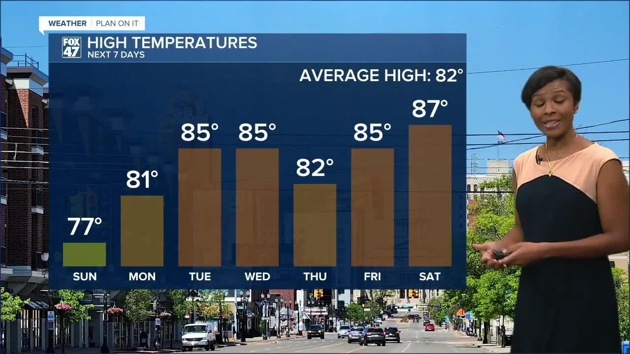
Sunday: Morning showers give way to partly sunny skies.
High: 77° | Low: 56°
Monday: Sunny and pleasant with low humidity.
High: 81° | Low: 55°
Tuesday: Mostly sunny and warmer. A great day to be outside.
High: 85° | Low: 62°
Wednesday: Partly sunny with scattered showers and thunderstorms developing as a cold front moves through.
High: 85° | Low: 63°
Thursday: Partly sunny with additional chances for scattered showers and thunderstorms.
High: 82° | Low: 62°
Friday: Warm and humid with scattered showers and thunderstorms possible. Some storms could become strong.
High: 85° | Low: 66°
Saturday: Partly sunny with more scattered showers and thunderstorms. Continue to monitor the forecast for potentially stronger storms.
High: 87° | Low: Mid 60s
Looking Ahead
Enjoy the sunshine while it lasts. Monday and Tuesday will provide some of the nicest weather of the week before a more active pattern returns.
Have a great weather picture or video to share? Send it our way and we may feature it on-air or online!

