
LANSING, Mich. — Clouds will gradually increase tonight as a cold front pivots south across the region. No wet weather is expected except for a small chance for a light shower closer to daybreak. Temperatures will dip toward the upper 40s with SSW winds easing to 5-10 mph.
Mostly cloudy skies will be in place throughout the day on Tuesday as the cold front stalls out overhead. At the same time, a strengthening area of low pressure will move across the central Plains toward the Great Lakes. This will set the stage for showers and thunderstorms to return after the evening commute, with highs hitting the upper 50s beforehand.
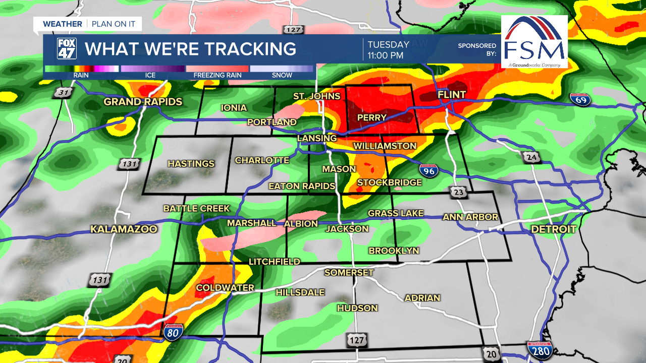
Hit-or-miss storms beginning between 5:00 - 7:00 PM Tuesday will become more widespread as a larger wave of activity rolls in closer to 11:00 PM. Additional waves of storms will continue throughout Tuesday night, ending with a final wave of heavy rain and thunderstorms Wednesday morning.
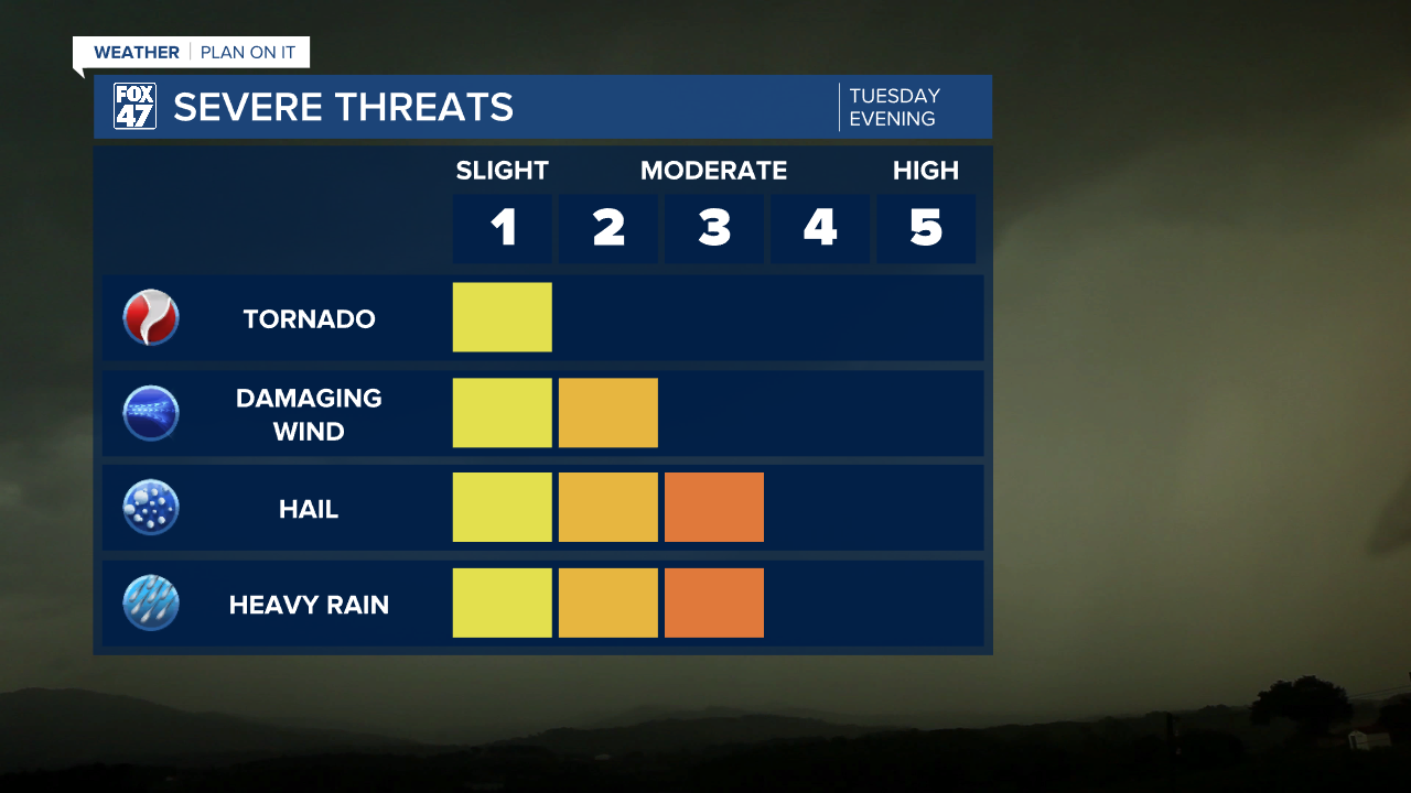
Any storm will have the potential to become severe, especially before midnight. Conditions this time favor a greater risk of large hail and damaging winds, but isolated tornadoes will also be possible. Make sure to stay weather aware, and have a way to receive warnings overnight.

The final round of storms moves out after 10:00 AM Wednesday, leaving mostly cloudy skies behind for the remainder of the day. Winds pivoting to the northwest at 10-15 mph will drag colder air back into the region, limiting highs to the upper 40s.
GET YOUR FOX 47 FORECAST HERE
Wednesday's cooldown sets us on a stretch of chillier weather that will carry into the start of next week. There will be some ups and downs between highs in the mid 40s to mid 30s, but we won't be spoiled by any more Spring weather in the immediate future. Thursday brings partly cloudy skies, but a series of disturbances will bring the potential for rain and snow Friday through Monday.

Want more FOX 47 News? Here's how you download our Roku app
You can also see the latest news from across our mid-Michigan neighborhoods by liking us on Facebook or following us on X.
