
LANSING, Mich. — Stubborn clouds will finally begin to loosen their grip on our neighborhoods tonight, with clearing skies expected to take shape through midnight. That clearing may be short-lived for some though, as cooling temperatures lead to some redeveloping low clouds as patchy fog closer to daybreak. Lows will fall to the upper 50s with light northeast winds at 5-10 mph.
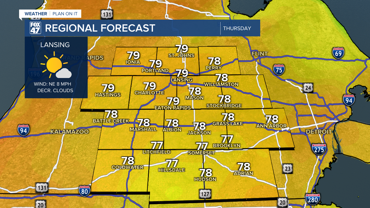
Any fog and cloud cover will dissipate over the course of Thursday morning, giving way to sunnier skies across our neighborhoods for the afternoon. Northeast winds will remain locked in at around 6-12 mph, keeping things comfortably mild with highs in the upper 70 to around 80.

Friday tees up another beautiful day to close out the work week. With high pressure still in control, we'll enjoy another day of mostly sunny skies with highs warming into the low 80s.
GET YOUR FOX 47 FORECAST HERE
A new cold front will bring a few hit-or-miss showers and thunderstorms to the region on Saturday. The day will not be a washout, but make sure to keep an eye on the sky if you have outdoor plans.

Following the cold front on Sunday, a much more Fall-like weather pattern takes over through the first half of next week. Highs will fall back to the low and mid 70s Sunday through Wednesday, with lows in the low 50s and possibly some upper 40s by Tuesday night.
Want more FOX 47 News? Here's how you download our Roku app
You can also see the latest news from across our mid-Michigan neighborhoods by liking us on Facebook or following us on X.
