
LANSING, Mich. — Partly cloudy skies will continue overnight, with the chance for an additional shower or thunderstorm after 3:00 AM. Warm and humid conditions will remain in place too, with lows only falling to around 70 degrees.

A cold front and an area of low pressure will move through the Great Lakes on Tuesday. After a possible isolated storm in the morning, a more widespread round of scattered showers and thunderstorms is expected between 3:00 PM and midnight.

Isolated severe storms will also be in the mix, with the potential for damaging winds. Stay weather aware, and be ready to seek shelter if storms head your way.
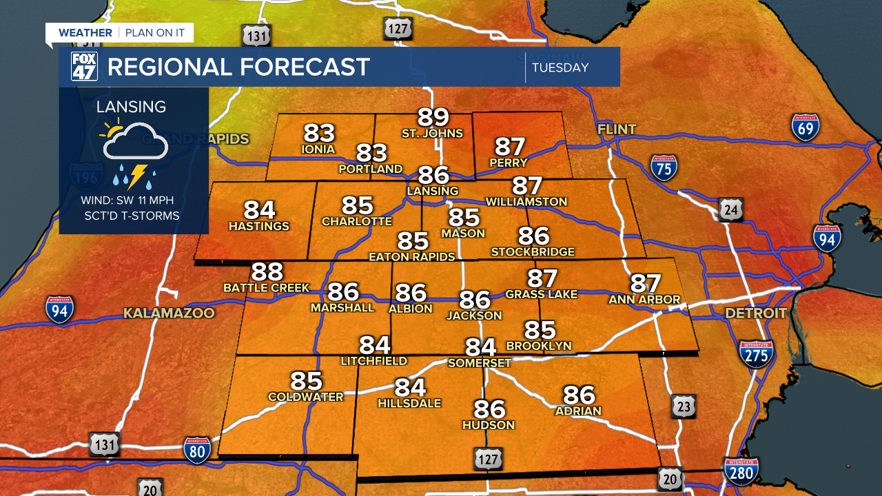
Expect a hot and humid day outside of any storms, with highs climbing to the middle and upper 80s. Locations that stay sunnier could spike closer to 90 degrees.

Conditions turn a bit more comfortable behind the cold front for the second half of the week. An isolated leftover storm is possible on Wednesday, but sunshine will be plentiful otherwise. Highs will dip to the mid 80s with a substantial drop in the humidity, and we'll remain on a similar course for Thursday and Friday under mostly sunny skies.

Enjoy the reprieve, because the heat and humidity will be back for the weekend. Highs return to the upper 80s and low 90s om Saturday and Sunday, with humidity spiking back to oppressive levels. Both days will feature the chance for a few hit-or-miss storms, so there will at least be some opportunity for some natural cooling.
Want more FOX 47 News? Here's how you download our Roku app
You can also see the latest news from across our mid-Michigan neighborhoods by liking us on Facebook or following us on X.
