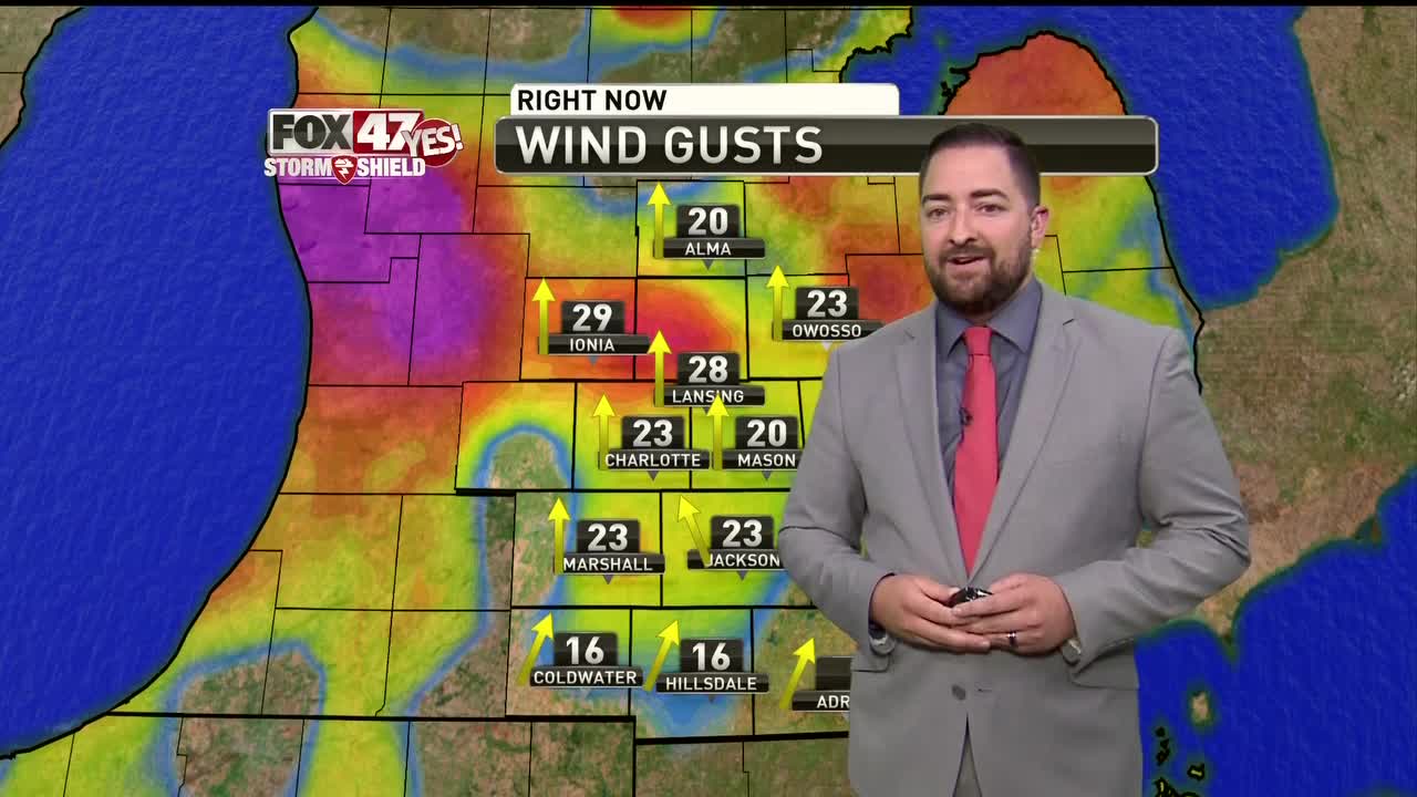

LANSING, Mich. — Scattered thunderstorms continue to train through Mid-Michigan bringing gusty winds and heavy rainfall. As these storms continue to develop and roll through, the threat for any of them to become severe does exist, especially in our northern counties where there is a severe thunderstorm watch in effect until 3 A.M. Primary concern for storms that become severe will be for damaging wind gusts and hail. Cells will likely continue to pop up for the next several hours, but by the wee hours of tomorrow morning we will begin to dry out as the front clears the region.
Labor Day looks nice with a mix of sun and clouds and temps climbing back into the 70s. Tuesday looks like it is going to be on the chilly side and starting off rainy as a stalled frontal boundary sets up over the Great Lakes Region. This boundary will bring continued chances for rain and storms through the week.
Want to learn more about the Weather? Visit the FOX47News Website.
Stay in touch with us anytime, anywhere.
Download our free app for Apple and Android
and
Sign up for newsletters emailed to your inbox.
Select from these options: Breaking News, Severe Weather, School Closings, Daily Headlines and Daily Forecasts.
