

LANSING, Mich. — After sneaking in a drier, and largely pleasant Monday, showers are set to return tonight along with the possibility for a few thunderstorms. A stray downpour will be possible before midnight, but wet weather will begin in earnest overnight. Scattered showers will develop into a steadier rain around daybreak, setting up a slippery morning commute. Lows tonight will remain fairly mild in the low 50s.
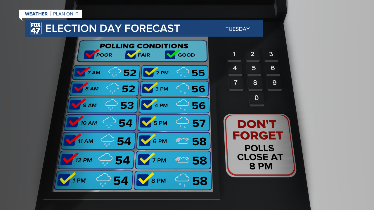

Light-to-moderate rain will continue throughout the morning on Tuesday as slow-moving low pressure finally begins to meander toward Michigan. Give yourself a little extra driving time for your morning commute, or if you're headed out to the polls for the special election. Rain will become more intermittent for the afternoon, but showers and an isolated thunderstorm will be possible until around the time of the evening commute. Highs will be held back a bit by the clouds and wet weather, only reaching the upper 50s to around 60.

With low pressure finally departing east on Wednesday, partly cloudy skies will take over for the middle of the week. Highs will get a nice boost thanks to the added sunshine, jumping to around 70 degrees. We'll slip to the upper 50s behind a dry cold front on Thursday, but with mostly sunny skies hanging on. Then we'll cap off the work week with sunny skies, and highs back to the mid 60s.

We warm back into the 70s this weekend, with overwhelmingly dry and sunny weather expected. Saturday will bring just a small chance for an isolated shower as a weak disturbance tracks through the Great Lakes, but this is not expected to pose a major risk to Saturday plans.
Want to learn more about the Weather? Visit the FOX47News Website.
Stay in touch with us anytime, anywhere.
Sign up for newsletters emailed to your inbox.
Select from these options: Breaking News, Severe Weather, School Closings, Daily Headlines and Daily Forecasts.
