
Showers Return Sunday
Temperatures will reach a high of about 52°F on Sunday. However, it will be very early in the morning. Due to a cold front, temperatures will drop throughout the day before reaching overnight lows of about 29°F. Weather conditions turn more active on Sunday as a system moves into the region.
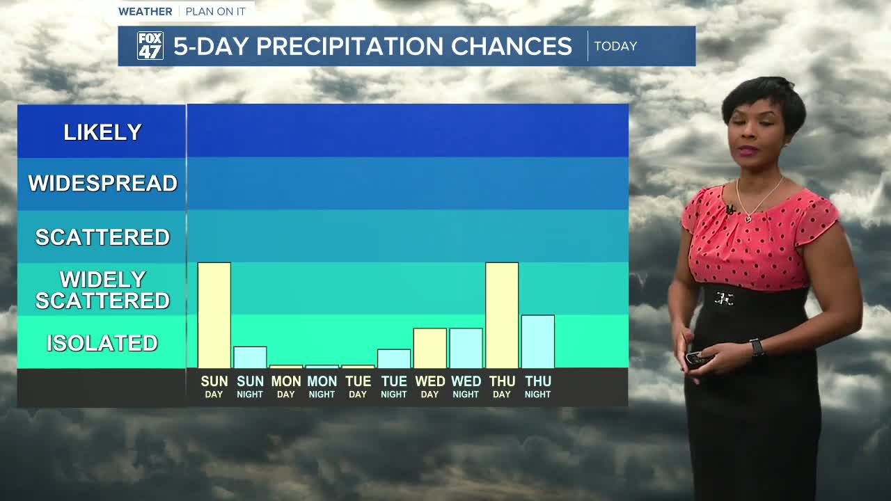
Scattered showers are expected to develop Sunday morning, especially across the northern parts of our neighborhoods. As the day progresses, rain will shift across the area in waves, bringing periods of moderate rainfall.
Some areas could also hear rumbles of thunder, particularly with heavier pockets of rain.
Rain chances will continue throughout the afternoon and evening before tapering off late Sunday night.
There is also a possibility of freezing rain developing Sunday evening in some locations, especially as temperatures begin to drop.
Drier and Cooler Start to the Week
Conditions improve heading into Monday as drier air moves into the region.
Monday will bring sunshine and dry weather, offering a break from the weekend rain.
However, cooler temperatures will settle in behind a cold front, with highs returning to the 40s through midweek.
Warmer Temperatures Return by Thursday
The cooler stretch will be short-lived.
Temperatures begin to climb again by Thursday, with highs returning to the 60s, although another chance of rain is expected to accompany the warmer air.
7-Day Outlook for Lansing and Jackson
Sunday: Showers — High near 52°
Monday: Mostly cloudy — High 43°
Tuesday: Partly Sunny- High 50°F
Wednesday: Mostly Cloudy — High 53°
Thursday: Chance of rain — High 59°
Friday: Partly Sunny — High 42°
Saturday: Mostly Sunny— High 46°
The Bottom Line
Drier and cooler conditions follow early next week, with temperatures rebounding again by Thursday.
Want more FOX 47 News? Here's how you download our Roku app
You can also see the latest news from across our mid-Michigan neighborhoods by liking us on Facebook or following us on X.
