
LANSING, Mich. — Our weather is in the process of taking a more unsettled turn, and its timing is less than ideal as we get into travel time ahead of and over Thanksgiving weekend. Cloudy skies this evening will give way to a few light showers between 8:00 PM and midnight. Showers will remain largely intermittent until about 4:00 AM, turning into a steadier rain by sunrise. Lows will remain mild for late-November, falling to around 40 degrees.
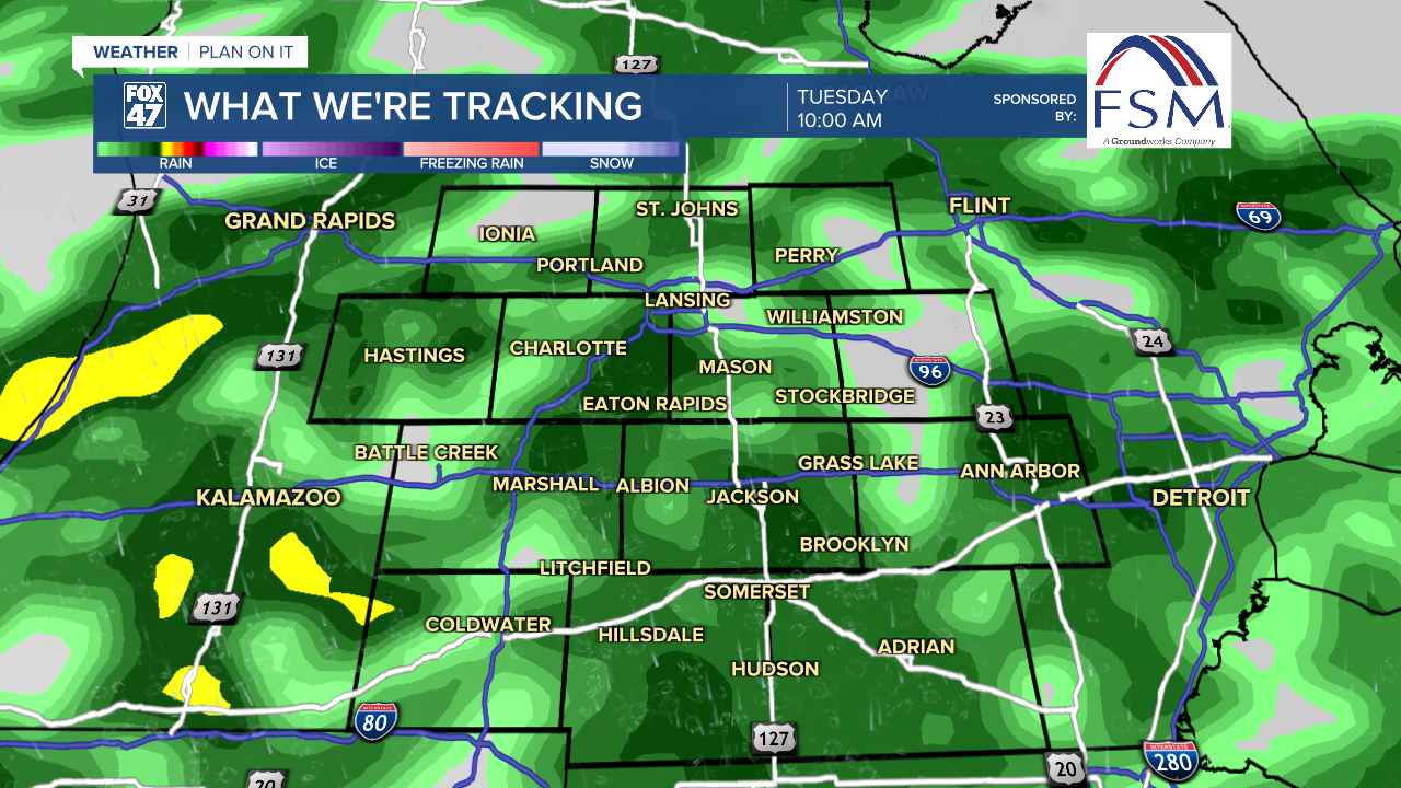
If your plan was to get an extra early jump on Thanksgiving travel on Tuesday, be ready to take it slower on slick roads. Periods of light to moderate rain will persist across our neighborhoods through midday Tuesday, gradually tapering off during the afternoon. If you can wait to leave until after 2:00 PM, that would be better for avoiding the wet weather. Highs will remain mild for one more day, climbing to around 50 degrees. Enjoy it while you can, because we're going to be taking a turn toward winter as we move into the holiday weekend.
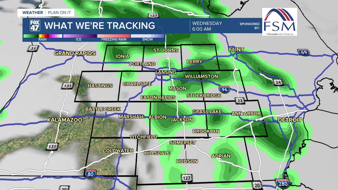
Following in the wake of Tuesday's disturbance, a new, more-potent low pressure system and cold front will sweep into the Great Lakes on Wednesday. This will bring a round of rain showers back to most neighborhoods before sunrise Wednesday, with those quickly changing over to snow showers during the rest of the morning.
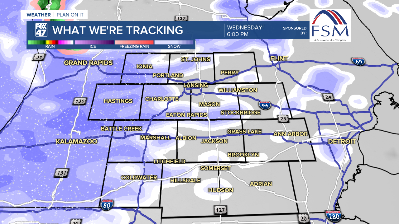
Winds will increase sharply behind the cold front in the afternoon, picking up to 15-25 mph and gusting up to 40 mph. The increasing winds combined with temperatures falling into the 30s will lead to an outbreak of lake effect snow showers on Wednesday afternoon, continuing at times into Thursday.
GET YOUR FOX 47 FORECAST HERE
Thanksgiving Day marks the beginning of a cold stretch that will carry us through the entire holiday weekend. If you're traveling to family gatherings on Thursday, be prepared for rapidly-changing road conditions, which could entail rapid drops in visibility and snow-covered roads due to continuing lake effect snow showers. It will also be a very cold day, with highs only set to reach the mid 30s, and wind chills hovering in the 20s. Make sure to layer up if heading out!
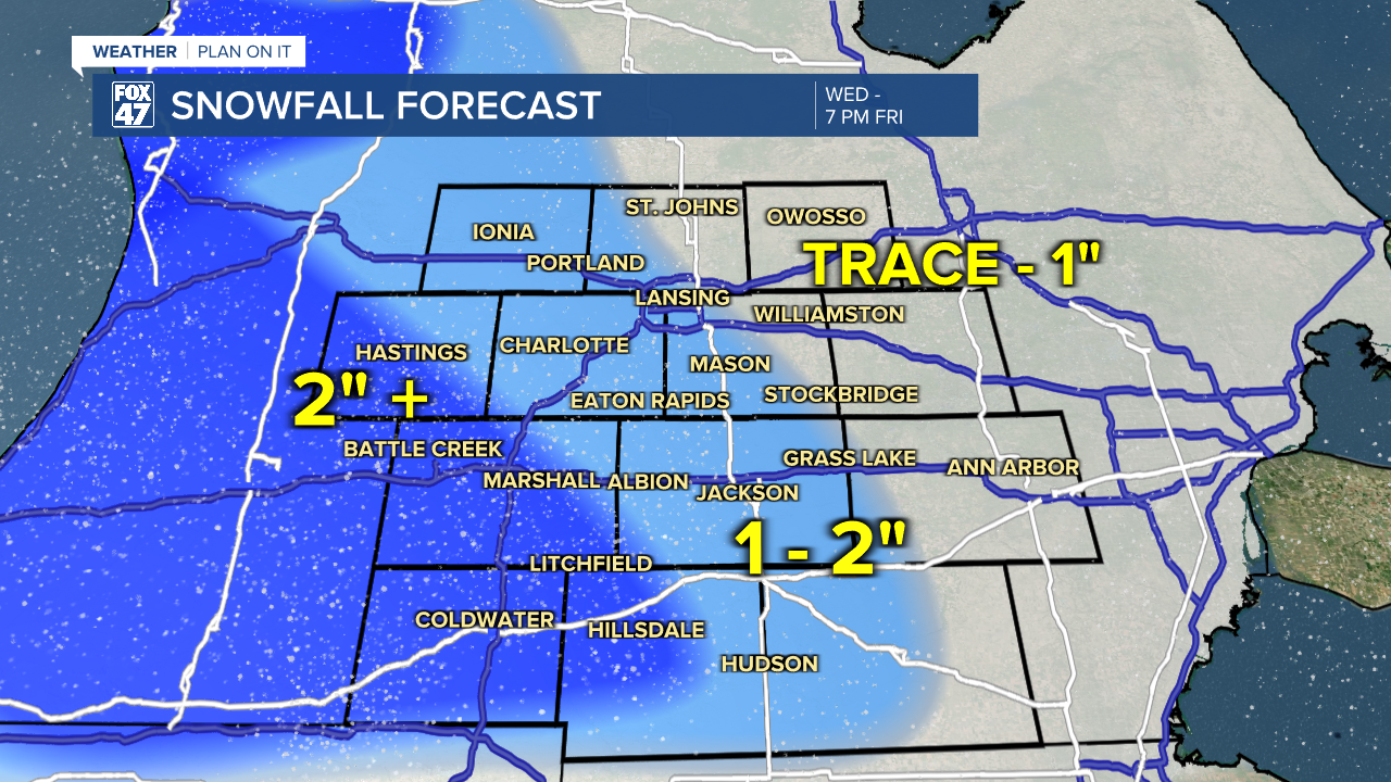
Light accumulations of snow are possible across our neighborhoods from Wednesday afternoon through Friday, combining Wednesday's disturbance and the lake effect snow that follows. Light amounts of up to 1" will be possible in our easternmost neighborhoods, with 1"-2" possible along much of the US-127 corridor. Locations west of I-69 could pick up 2" or more where lake effect snow is heavier and more persistent. Given the extended period of this event, this snow might not be on the ground all at once.
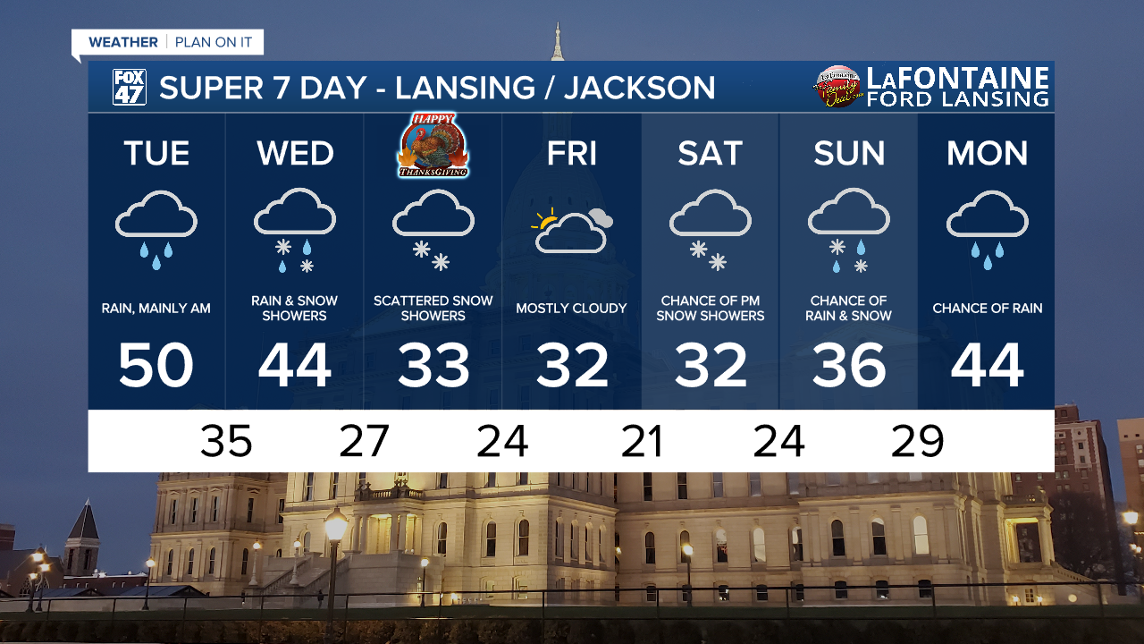
Arctic air sticks around on Friday, but we get a break from the snow showers under mostly cloudy skies. Dress warmly if you're headed out for some Black Friday shopping as highs will remain stuck in the low 30s. Highs stay in the 30s on Saturday and Sunday, with the potential for another disturbance heading our way. Returning snow showers will be possible late Friday afternoon, becoming more of a rain/snow mix on Sunday. This could mean another round of messy travel home from the holiday weekend, so make sure to keep an eye on the forecast, and plan accordingly.
Want more FOX 47 News? Here's how you download our Roku app
You can also see the latest news from across our mid-Michigan neighborhoods by liking us on Facebook or following us on X.
