
LANSING, Mich. — Partly cloudy skies this evening will give way to increasing clouds overnight as a potent low pressure system moves into the Great Lakes. A stray shower will be possible around daybreak, with temperatures briefly dipping to the upper 40s, then climbing back to the mid 50s by sunrise.
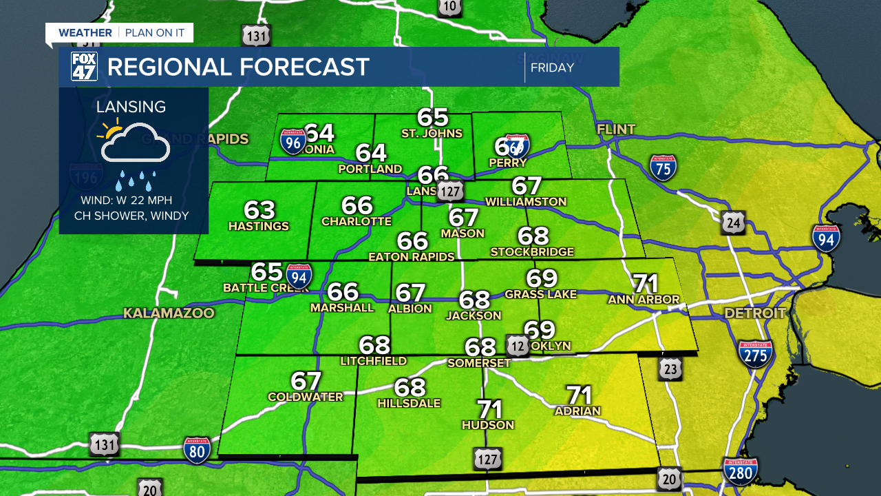
A few showers may pass through our neighborhoods during the Friday morning commute, but the bigger story on Friday will be the increasing winds. As sun and clouds take over by midday, westerly winds will increase to 15-25 mph, with gusts up to 35 mph at times.
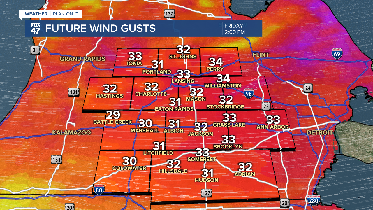
Take some time tonight to secure any loose items around your home like patio furniture and garbage cans. Make sure to keep a tight grip on your steering wheel too, especially if you drive a high-profile vehicle. Highs Friday will remain on the cooler side in the mid 60s.
GET YOUR FOX 47 FORECAST FORECAST
The first weekend of September will remain cool and Fall-like, with rain looking to stay out of the way. Saturday is expected to feature mostly cloudy skies, with a slightly sunnier day on tap for Sunday. No major changes to temperatures, with highs in the 60s and lows remaining in the 40s both days. If you've been looking for an excuse to break out the apple cider and doughnuts, here it is!

After one more day in the 60s on Monday, temperatures start to trend a little warmer on Tuesday. Highs will inch back into the low 70s, and will stay there on Wednesday and Thursday with plenty of sunshine expected.
Want more FOX 47 News? Here's how you download our Roku app
You can also see the latest news from across our mid-Michigan neighborhoods by liking us on Facebook or following us on X.
