

Rain and snow showers, some mixed with sleet, will continue through roughly 8:00 PM this evening. As high pressure begins to build in from the north, skies will gradually clear after midnight. This will allow a wave of colder air to settle over the region, forcing lows into the mid 20s by daybreak. This could lead to some refreezing of wet surfaces, so tread cautiously on your way out the door in the morning!

Wednesday starts out with mostly sunny skies amid those cold temperatures in the 20s. Clouds will increase a bit during the afternoon, but no new rain or snow showers are expected. Highs will remain chilly in the low 40s, with light ENE winds at 3-6 mph.
GET YOUR FOX 47 FORECAST HERE
A new cold front rolls out of the central United States on Thursday, keeping skies mostly cloudy throughout the day. A few showers will be possible later in the evening as the front sweeps through the region. Before the front arrives, highs Thursday afternoon will take a milder turn into the upper 40s.

The chance for a few showers will linger into Friday morning, but will end quickly in the wake of the passing cold front. This will pave the way for some clearing in the afternoon with more mild temperatures reaching the upper 40s to around 50. All of this bodes well for the Silver Bells festivities getting underway in Lansing on Friday evening!
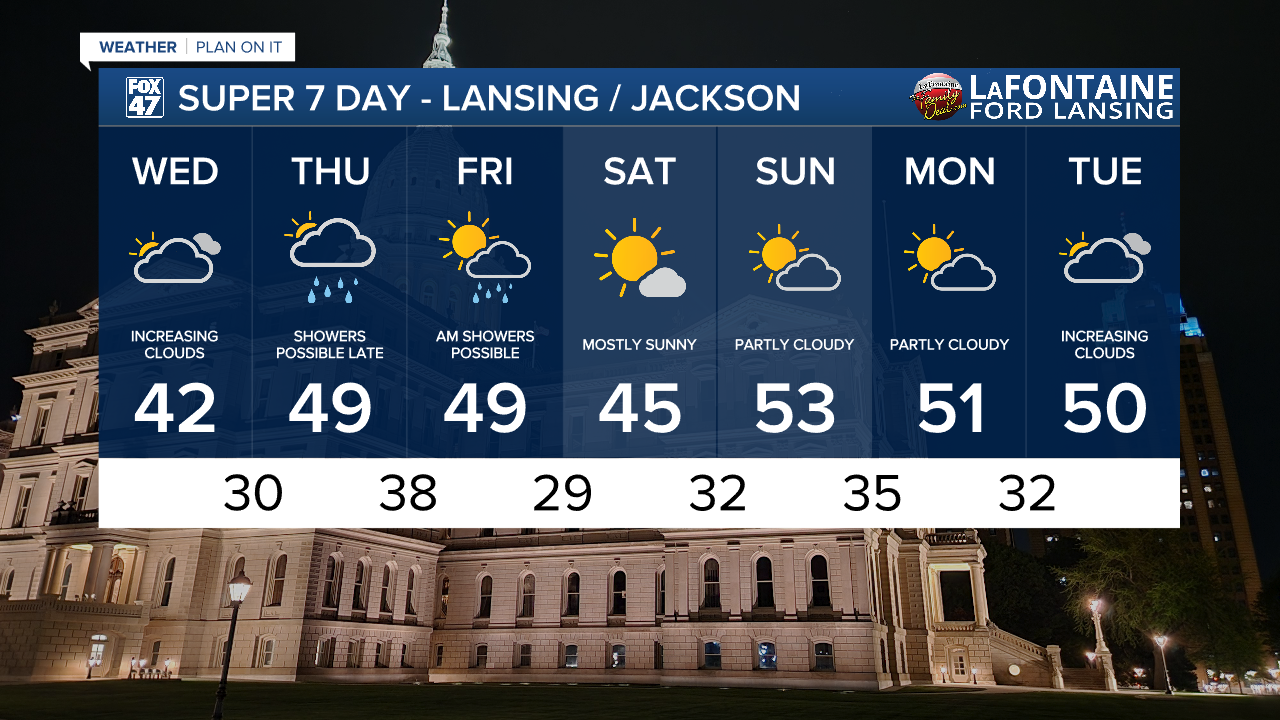
This weekend continues to look pleasant. Partly to mostly sunny skies are expected both Saturday and Sunday, and our temperatures will continue on a small warming trend. Highs will start in the mid 40s on Saturday, then warm to around 50 on Sunday. More dry weather is expected Monday and Tuesday, with highs remaining in the low 50s.
Want more FOX 47 News? Here's how you download our Roku app
You can also see the latest news from across our mid-Michigan neighborhoods by liking us on Facebook or following us on X.
