

Skies will clear and winds will diminish somewhat in the wake of a passing cold front tonight. This will set us up for a colder night, with lows taking a dive toward the low 30s by morning. Wind chills will likely hover in the upper 20s as many of us are heading out the door Thursday morning, so be ready to bundle up!

Thursday starts off with mostly sunny skies as high pressure passes just south of us across the Ohio Valley. We'll keep the sunshine going through lunchtime, followed by returning clouds in the afternoon ahead of another disturbance. Highs will run a little cooler than the past couple of days, stopping right around average in the low 50s. Winds will be lighter out of the WSW at only 4-8 mph, making for a more pleasant day overall.
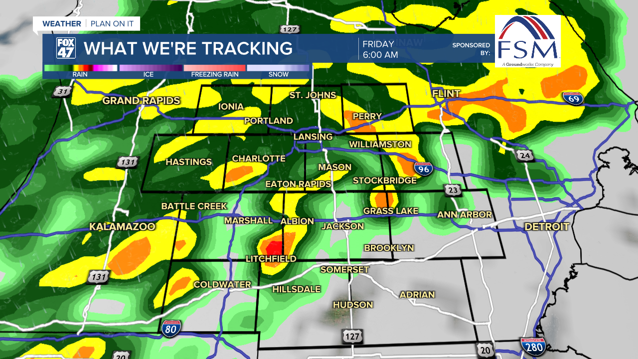
Clouds will continue to build into Thursday night as an area of low pressure tracks toward the Great Lakes. We'll remain dry for the first half of the night, but a wave of showers will sweep in after 3:00 AM, continuing into Friday morning. While the chance is low, a few thunderstorms will be possible before showers wrap up around midday Friday. Highs will return to the upper 50s one more time, with fresh round of breezy conditions taking over for the end of the work week.
GET YOUR FOX 47 FORECAST HERE
Friday's cold front will usher in the coldest air of the season so far this weekend. We'll get a break between disturbances on Saturday, with a mostly cloudy day to start the weekend. Highs will be held to just the mid 40s though, and we'll be dropping more on Sunday and Monday as an upper-level trough settles in across the eastern United States.
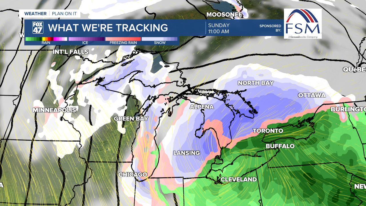
Along with that, a new clipper system will dive southeast across the Great Lakes on Sunday. With highs expected to stay in the upper 30s, this system is expected to bring some of our first snow of the season with it. Some rain may mix in, but a period of widespread snow showers is likely through the morning on Sunday, gradually tapering off with windy conditions in the afternoon. It is too early to pin down any specific numbers, but it is possible that some of our neighborhoods will see a light accumulation by Sunday evening.

Cold, breezy conditions persisting behind the system on Monday are likely to kick up some lingering lake effect snow showers across the region. Highs will be held to the mid 30s, with wind chills closer to the middle and upper 20s at times.
Want more FOX 47 News? Here's how you download our Roku app
You can also see the latest news from across our mid-Michigan neighborhoods by liking us on Facebook or following us on X.
