

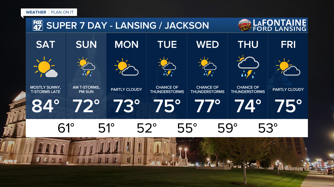
Today is looking good during the day, but a new cold front will begin to approach from the west later in the evening. Much of the day will feature mostly sunny skies, with temperatures trending slightly warmer in the low to mid 80s. Humidity levels will also tick up slightly, but will not be nearly as high as what we dealt with during the week.
GET YOUR FOX 47 FORECAST HERE
Clouds will increase in the evening ahead of the cold front, with an isolated shower or thunderstorm possible after sunset. A more significant round of storms will arrive between 3:00 AM and daybreak on Sunday, and an isolated severe storm cannot be ruled out north and west of Lansing. Main concern is damaging winds, along with some heavy downpours.

Scattered thunderstorms will linger through mid-morning on Sunday, making for a soggy start to the day. If you have outdoor plans, moving them to the afternoon if possible will be the better option. Leftover showers clear out after midday, giving way to increasing sunshine for the afternoon hours. Highs will hold well below average, but pleasant in the low 70s.

Monday starts the work week off on a dry note, with chances for showers and storms returning Tuesday through Thursday. Much of the week will see below average temperatures, in the low to mid 70s, but at least it will still be comfortably warm.
Have a great weather picture or video to share? Send it our way and we may feature it on-air or online!

