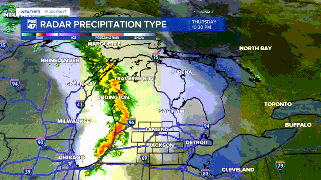
The Grand Rapids National Weather Service Office has issued their Preliminary Storm Reports from last night's severe weather event. Overall, our northern neighborhoods saw a lot of wind damage causing power outages and fallen debris on roadways.

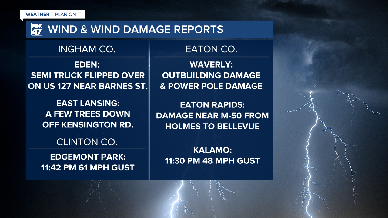
Starting in Waverly, Emergency Management reported a Tornado located on Millet Highway between S Canal Rd. and South Creyts Rd.. This area saw a semi truck overturned as well as spotter reports of power flashing. This are aligns with the radar debris signature at the time. This radar confirmation is still awaiting damage assessment before it receives an official rating on the EF-Scale.
LEARN MORE ABOUT WHAT THE EF-SCALE IS BELOW
Other main impacts included our winds which caused quite a lot of damage across our neighborhoods. Below, you can see the remainder of the preliminary storm reports issued by the National Weather Service Friday morning.
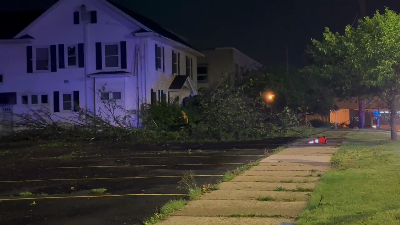
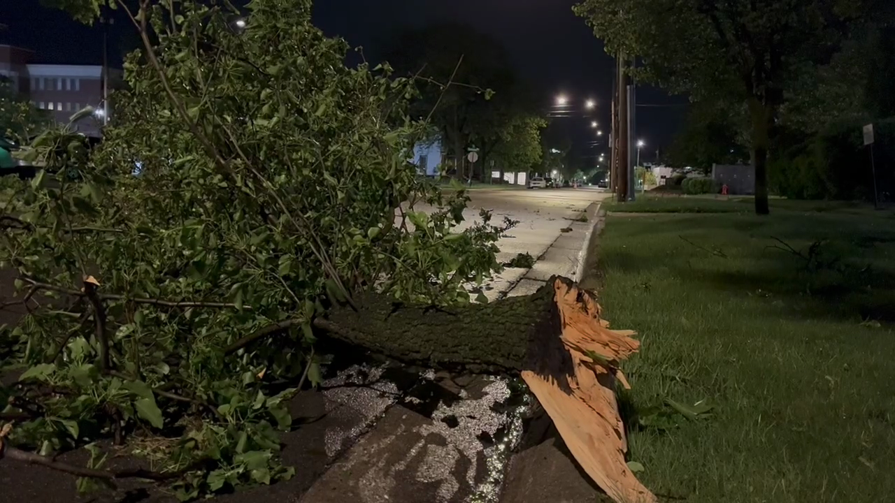
We saw a lot more tree damage across Lansing this morning including a brief closure on I-496 in the 3 AM hour of Friday due to downed power lines. Below is images across Lansing with debris from this morning.
INTERSECTION OF WALNUT AND HILLSDALE
ACROSS DOWNTOWN LANSING

FORECAST UPDATE
This afternoon will bring plenty of sunshine with our high temperatures warming into the 80's. An area of low pressure will track east towards northern Michigan, driving another round of thunderstorms into our area.

WATCH THE FULL FORECAST BELOW
By sunset, our present instability in the atmosphere will begin to decrease as elevated wind shear will allow for potential damaging winds up to 55 mph. This could cause some more storm damage to limbs or power lines that are close to falling. There is also a chance for hail this evening as well. We also can't eliminate the chance for a tornado in our neighborhoods this evening. The tornado threat is much lower than Thursday night's due to the lack of moisture. The Storm Prediction Center currently has all of our neighborhoods under a Slight Risk for severe weather this evening.

Timing for these storms is from 9PM to 2AM Friday night. Once this area of low pressure exits our area, we will cool down with highs in the mid to lower 60's. Tame showers are possible throughout the day Saturday with low impacts expected.

Want to learn more about the Weather? Visit the FOX47News Website.
Stay in touch with us anytime, anywhere.
Sign up for newsletters emailed to your inbox.
Select from these options: Breaking News, Severe Weather, School Closings, Daily Headlines and Daily Forecasts.
