
LANSING, Mich. — Clouds will decrease tonight as a mild air mass continues to settle over the region. We'll still wind up with a slight chill in the air, but lows will only dip to the mid 40s. Winds will continue out of the SSW at 5-15 mph.

We ease into the work week with some pleasant Spring weather. Partly to mostly sunny skies in the morning will eventually give way to increasing clouds later in the afternoon. Temperatures will run well above average for the end of March, climbing all the way to the middle and upper 60s. Enjoy it while you can, because things will turn much stormier as head into Tuesday.
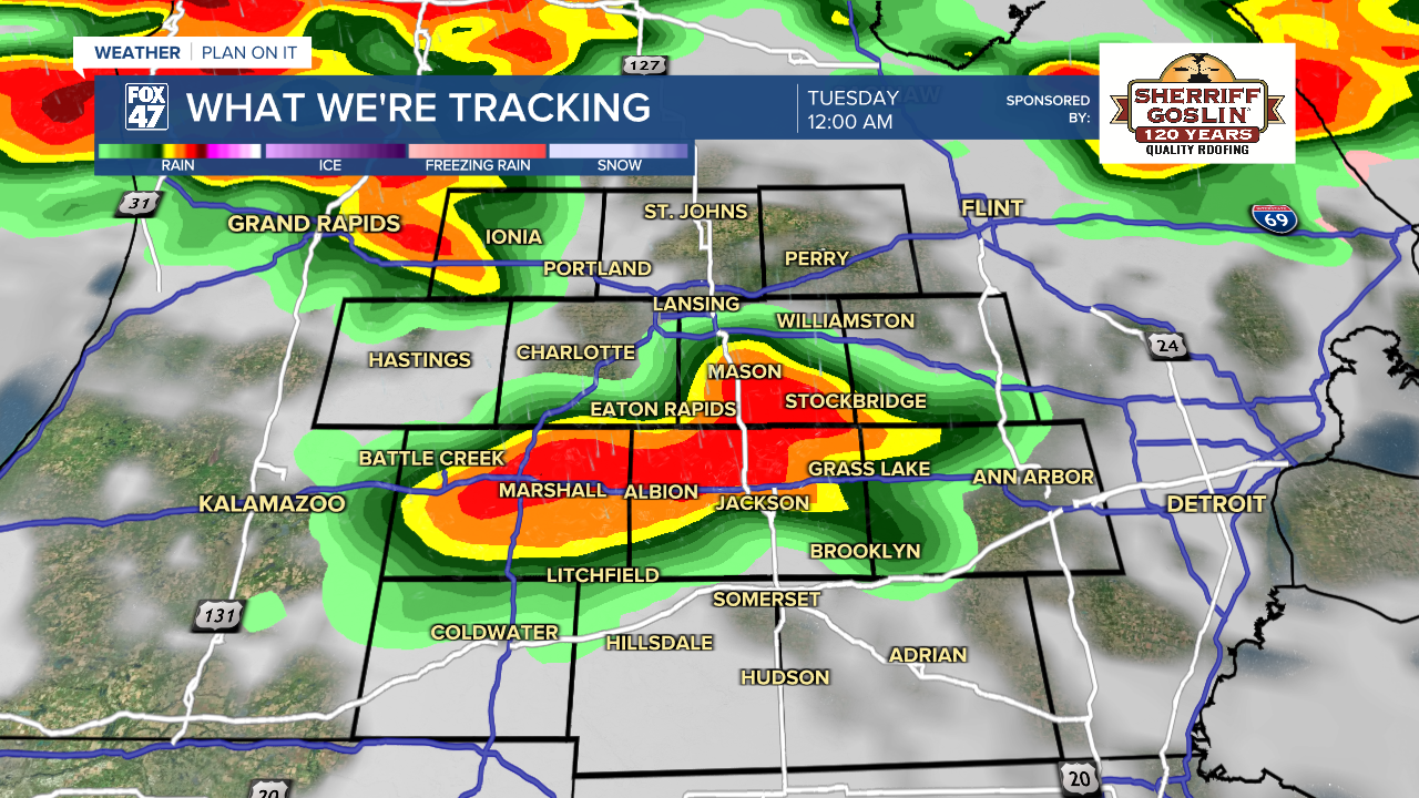
A slow-moving cold front will settle over the state Monday night, setting the stage for several rounds of thunderstorms to sweep through the region. The first round sweeps in shortly after midnight Monday, followed by a second settling in for the Tuesday morning commute. Isolated severe storms will be possible, with the potential for damaging winds and large hail.

Expect treacherous conditions on the Tuesday morning drive, including the potential for localized flooding. Additional rounds of thunderstorms are expected throughout the day, with an increased potential for severe storms in the afternoon thanks to temperatures climbing into the 70s. Along with the continued risk of damaging winds and large hail, a low risk for tornadoes will also be on the table. Stay weather aware, and be prepared to seek shelter if necessary.

Temperatures take a dive back to the 40s on Wednesday behind the cold front. Some lingering showers in the morning will give way to mostly cloudy skies for the rest of the day. 40s stick around on Thursday, with a new disturbance bringing the chance for a wintry mix.
We trend back toward the 50s and 60s in time for the weekend, but an unsettled weather pattern will remain in place. Each day will feature the chance for showers and even some thunderstorms starting on Saturday.
Have a great weather picture or video to share? Send it our way and we may feature it on-air or online!

