
LANSING, Mich. — Overnight: Patchy fog will move through, which might reduce visibility. Use caution while driving. Temperatures should reach an overnight low of 28°F.
Monday: Temperatures continue to climb with an expected high temp of 51°F. Mostly cloudy conditions prevail, but isolated showers will pop up in some of our southern neighborhoods, like Coldwater and Jackson, after 5:00 p.m.
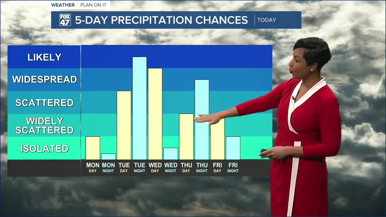
Tuesday-Wednesday:
These are the warmest days of the week, with temperatures soaring to 49°F on Tuesday and 60°F by Wednesday. Although we have chances for scattered showers during the day on Tuesday, precipitation chances really ramp up Tuesday night as widespread rain moves across our neighborhoods and sticks around through Wednesday during the day. This is due to a low-pressure system moving through. Isolated thunderstorms are possible. We will continue to keep an eye on this system.
Thursday -Friday:
Temperatures stay quite warm, topping out about 54°F on Thursday and 45°F on Friday. Another system we are tracking brings additional chances for rain, then snow showers or a wintry mix as temperatures drop at night.
Saturday-Sunday: Temperatures return to the low to mid 30s with chances for a wintry mix at times.
Want more FOX 47 News? Here's how you download our Roku app
You can also see the latest news from across our mid-Michigan neighborhoods by liking us on Facebook or following us on X.
