
LANSING, Mich. — Scattered thunderstorms will gradually diminish this evening, with most of the activity wrapping up by 10:00 PM. Partly cloudy skies will linger overnight, but leftover ground moisture from today's rain will set up favorable conditions for patchy fog. Expect pockets of poor visibility in time for the morning commute, with comfortable lows in the low 60s.

Patchy fog and low clouds will gradually dissipate on Thursday morning, giving way to mostly sunny skies as a more stable air mass settles in over Michigan. Humidity levels will drop quite a bit, making for a much more comfortable day to get outside with highs in the low 80s.
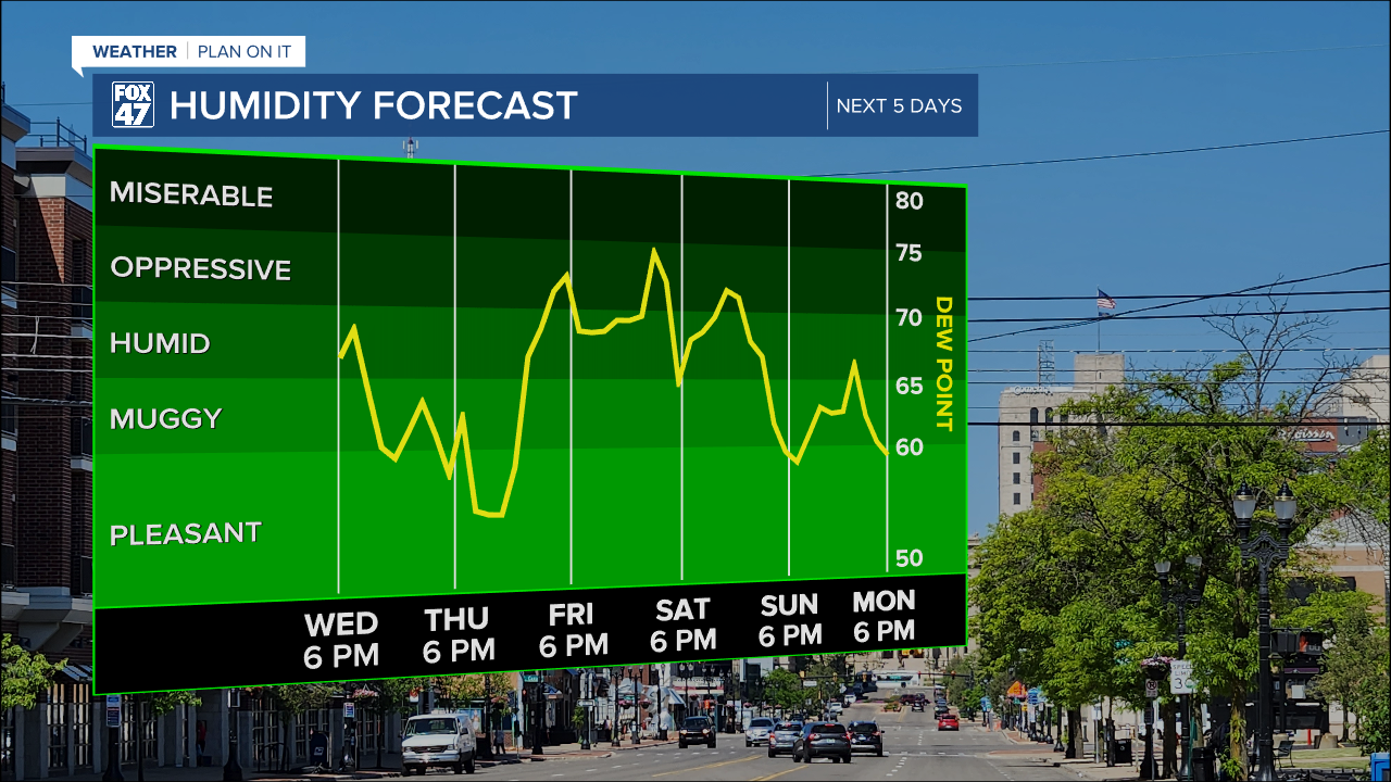
Humidity levels jump right back up on Friday thanks to a warm front sweeping across Mid-Michigan. Scattered thunderstorms will be possible mid-to-late morning as the front comes through, with more storms possible in the afternoon and evening. Highs will return to the mid 80s, and stay there on Saturday when a more widespread wave of showers and thunderstorms is expected.
GET YOUR FOX 47 FORECAST HERE
A leftover thunderstorm will be possible on Sunday, but the day will feature more sun overall. This will continue with a mix of sun and clouds Monday and Tuesday, with highs holding in the middle to upper 80s through that stretch.
Want more FOX 47 News? Here's how you download our Roku app
You can also see the latest news from across our mid-Michigan neighborhoods by liking us on Facebook or following us on X.
