


LANSING, Mich. — Scattered showers and a few thunderstorms will make their way through many of our neighborhoods early this evening, bringing some heavy downpours and possibly some gusty winds. Showers will be most numerous before 8:00 PM, leaving behind some isolated showers overnight. Temperatures will remain mild, only falling into the low 60s by daybreak.
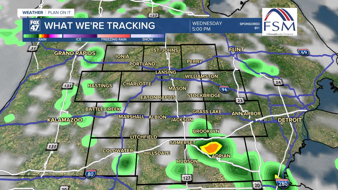
Unsettled, muggy weather will continue on Wednesday as the center of low pressure moves in over Michigan. Cloudy skies and isolated showers in the morning are likely to give way to a bit of sunshine in the afternoon. This will act to destabilize the atmosphere a bit more than on Tuesday, leading to more widespread showers and thunderstorms on Wednesday afternoon and evening. Severe weather remains unlikely for now, for storms could produce gusty winds and heavy downpours. Highs will generally range from the low to mid 70s, but could spike a bit higher where sunshine breaks out longer.
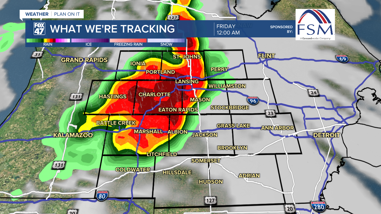
We go through a bit of a handoff on Thursday, as our current low pressure system moves east and makes way for an approaching cold front. The upside is that most of the day on Thursday will feature partly to mostly sunny skies, and the chance for an isolated afternoon storms.
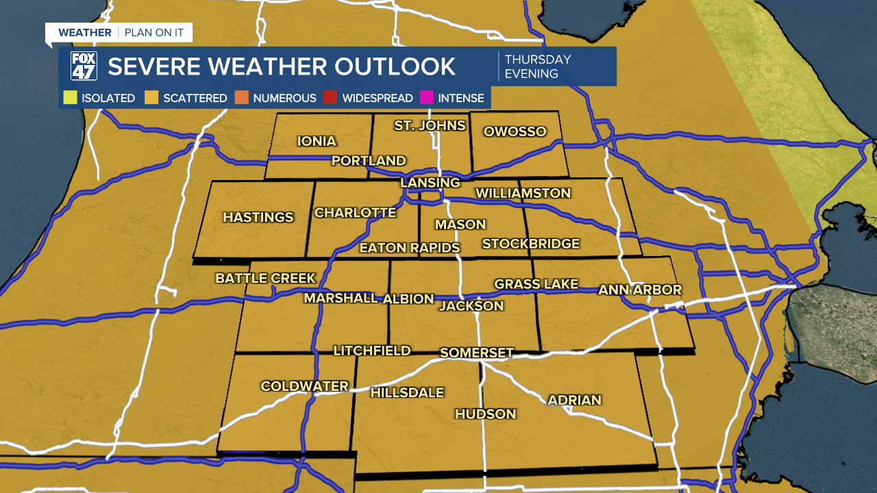
Highs will return to the low 80s, but that added warmth could leave us open to scattered severe storms late Thursday evening as the cold front begins to move in. These storms, developing in Wisconsin on Thursday afternoon are likely to cross Lake Michigan and sweep into our neighborhoods between 10:00 PM and 2:00 AM Thursday night. Damaging winds are likely with these storms, along with the potential for large hail and isolated tornadoes. Stay tuned to Fox 47 for updates over the next 48 hours.

Friday brings increasing sunshine in the wake of Thursday night's storms. Mostly sunny skies will be accompanied by breezy conditions, as highs hang on to the upper 70s for one more day. From there, we settle into cloudier skies and cooler 60s over the weekend, with the chance for showers on Saturday.
Want to learn more about the Weather? Visit the FOX47News Website.
Stay in touch with us anytime, anywhere.
Sign up for newsletters emailed to your inbox.
Select from these options: Breaking News, Severe Weather, School Closings, Daily Headlines and Daily Forecasts.
