


LANSING, Mich. — Another quiet and pleasant night is ahead of us as high pressure remains in place of the Great Lakes. Mostly clear skies will continue as lows eventually dip to the low 60s. Winds will turn calm.
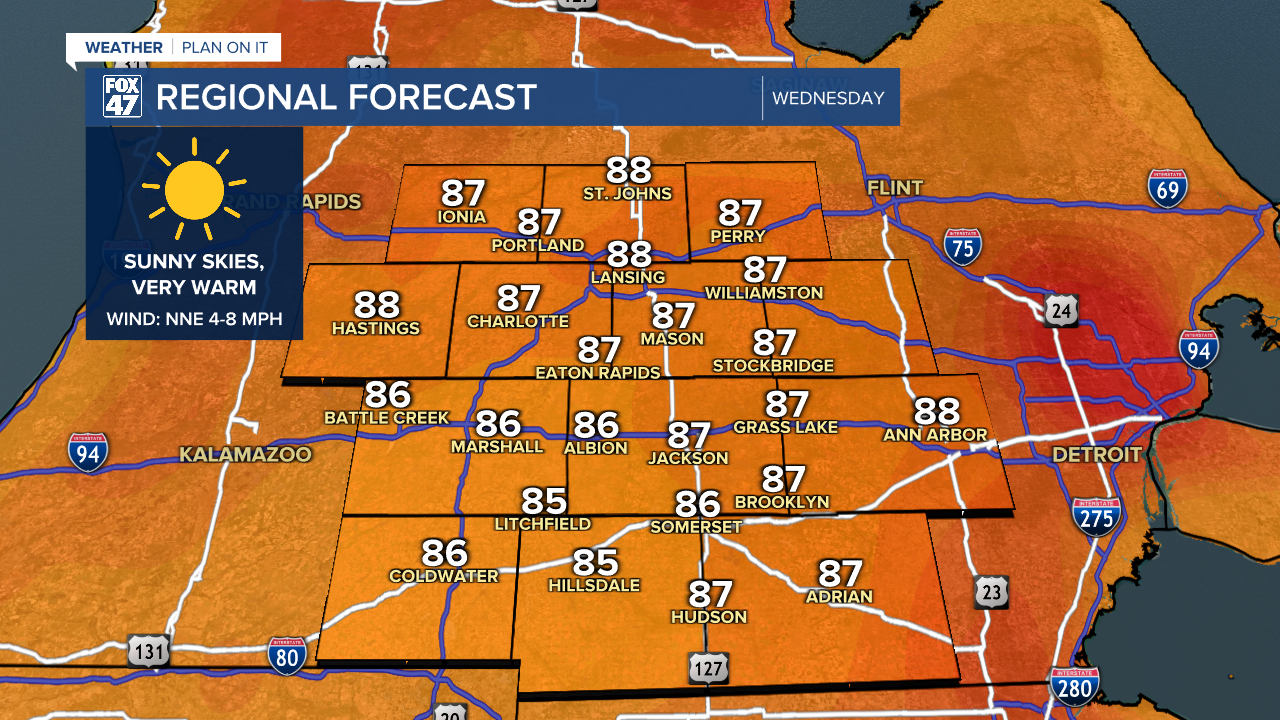
Wednesday will be similar to Tuesday with another round of mostly sunny skies on tap. Temperatures will continue to run very warm in the upper 80s, and we will feel a slight increase in humidity thanks to a west-southwesterly shift in the wind.
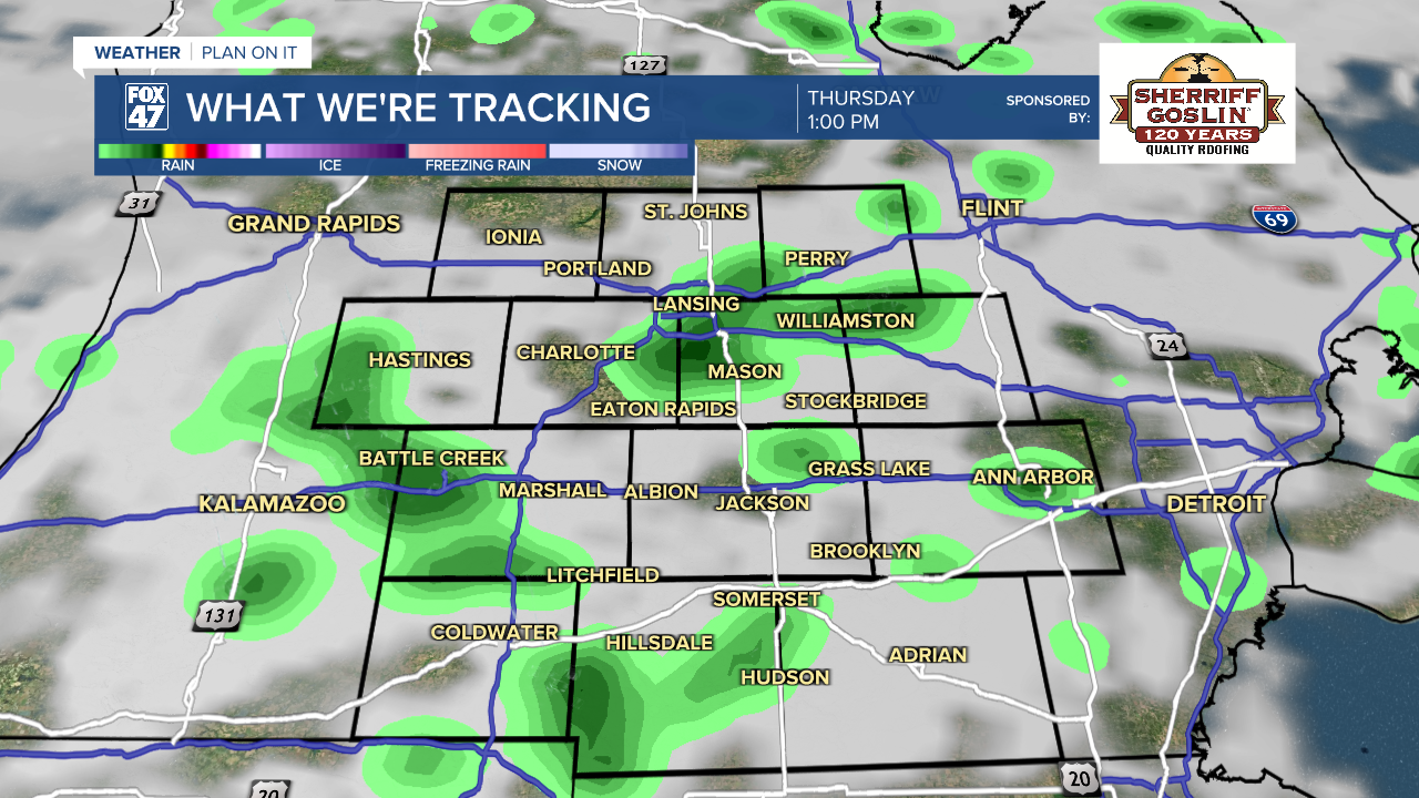
A cold front will begin to slowly approach from the northwest late Wednesday night, and could bring an isolated shower or thunderstorm to our neighborhoods before daybreak Thursday. Additional showers and thunderstorms will develop Thursday afternoon as the front taps into temperatures in the mid 80s and increased humidity.

The main threat for severe weather on Thursday currently looks like it will remain southwest of our neighborhoods, but it will be close enough to bear watching. Regardless, storms could still produce heavy downpours, gusty winds, and frequent lightning, so keep an eye on the sky if you plan to be outdoors.
GET YOUR FOX 47 FORECAST HERE
The cold front will stall out across Indiana and Ohio on Friday, remaining close enough to keep the chance of an isolated shower or thunderstorm in play for our neighborhoods. We'll see a mix of sun and clouds otherwise, with highs in the low 80s. The passage of the cold front will also knock the humidity levels back down a bit, making for a more comfortable end to the work week.
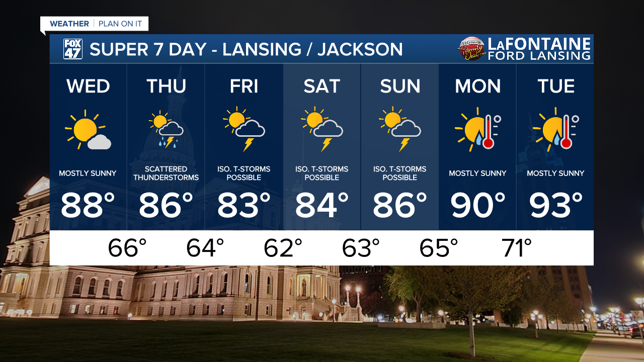
Isolated storms will remain a possibility over the weekend, but generally dry weather is expected. Highs will hold in the mid 80s on Saturday and Sunday, followed by a return to the low 90s on Monday and Tuesday.
Have a great weather picture or video to share? Send it our way and we may feature it on-air or online!

