
FROST ADVISORY in effect from midnight until 9:00 AM Friday.
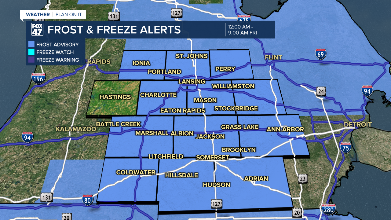
It's another night to protect your plants, and to keep your pets indoors. With high pressure continuing to hover near the Great Lakes, clear skies and light winds will bring another round of scattered frost to the region. It won't be quite as cold as Wednesday night, but we're still looking at lows in the middle to upper 30s overnight. Be ready to break out your ice scrapers again in the morning!
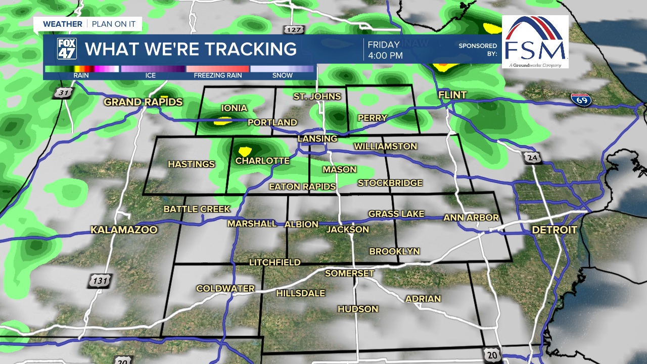
A new disturbance remains on track too arrive in our area late Friday. Clouds will gradually increase ahead of it throughout the day, followed by the possibility of showers beginning around mid-afternoon. Highs Friday will climb a couple of degrees higher, reaching the mid 60s in most neighborhoods. Expect a light breeze, with SSW winds at 6-12 mph.
GET YOUR FOX 47 FORECAST HERE
The rain will not be as significant as what fell on Monday night and Tuesday, but occasional showers will continue through Friday night and are expected to linger into a portion of Saturday. Mostly sunny skies remain intact for Sunday though, making for a beautiful second half of the weekend. After holding in the mid 60s on Saturday, highs will climb to the upper 60s on Sunday.
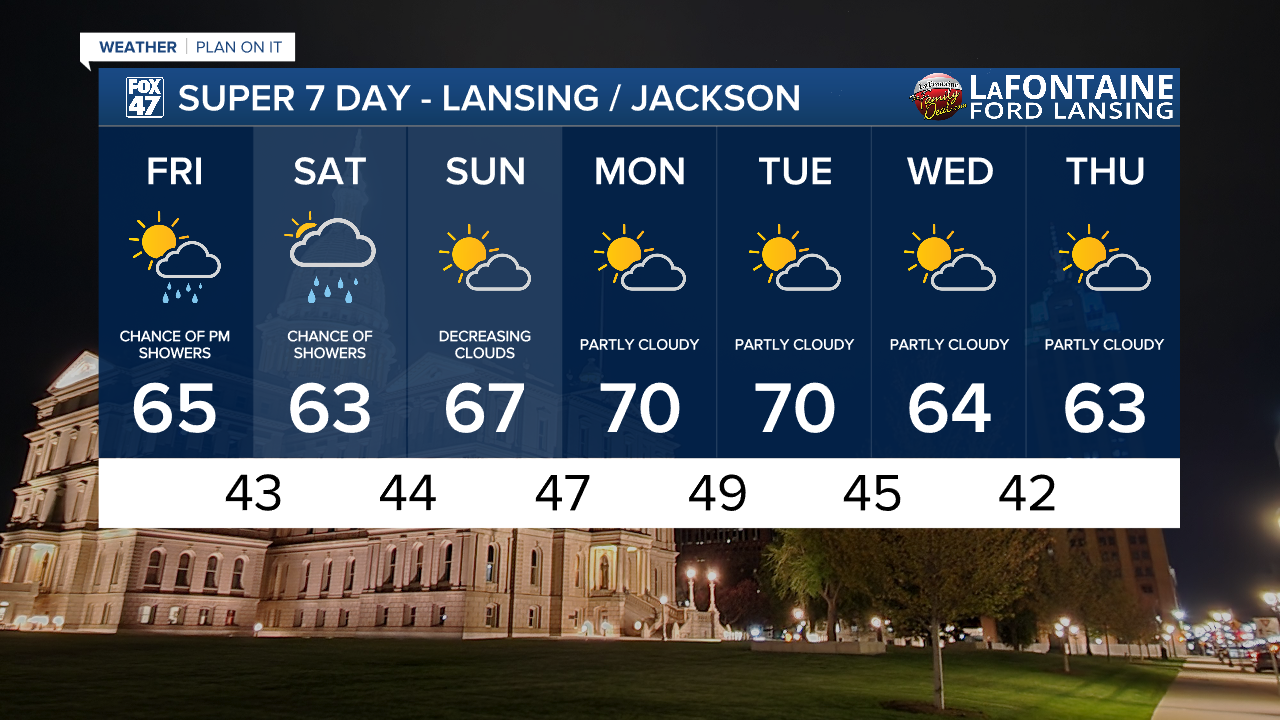
Looking ahead to next week, another stretch of predominantly dry weather is ahead. We'll look for partly cloudy skies Monday through Thursday, with some unseasonably warm air to start the work week. It won't rise to the level of summer warmth, but highs will top out around 70 degrees on Monday and Tuesday. We'll trend back closer to normal in the low 60s by Wednesday and Thursday.
Want more FOX 47 News? Here's how you download our Roku app
You can also see the latest news from across our mid-Michigan neighborhoods by liking us on Facebook or following us on X.
