

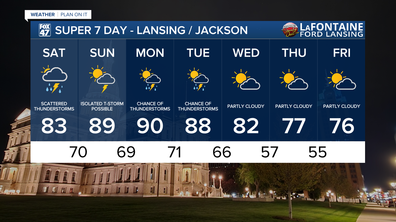
To brings a renewed push of more widespread showers and thunderstorms as an area of low pressure tracks in along the stalled front. Thunderstorms will become increasingly widespread this morning, and continue in earnest until about 2:00 PM. Additional isolated storms will be possible well into tonight, but the late-afternoon and evening hours on Saturday are expected to be quieter overall. Tropical levels of humidity will persist, but with highs holding in the low 80s, we'll stay out of extreme heat territory.

Isolated severe storms will be possible on today, with the threat greatest in the morning and early-afternoon when storms are at their most widespread. Damaging winds and large hail are possible, so make sure to keep an eye on the sky and have a backup plan if you were hoping to be outdoors.
GET YOUR FOX 47 FORECAST HERE
The storm threat eases a bit on Sunday, but an isolated shower or thunderstorm can't be completely ruled out for the second half of the weekend. A mix of sun and clouds is expected outside any pop-up storms, and it will be a bit hotter. Highs are set to return to the upper 80 on Sunday, with humidity pushing heat indices toward the mid 90s.

Heat takes one more big shot at us on Monday as high return to around 90 degrees. Heat indices will jump to the upper 90s to around 100 degrees in the afternoon, with the chance for scattered showers and thunderstorms. Highs will stay in the upper 80s on Tuesday with one more chance for storms, then the second half of the week brings relief! Highs fall to the low 80s on Wednesday, then the middle and upper 70s Thursday and Friday. All of that comes with a break in the humidity, setting up a stretch of comfortable weather that could take us into next weekend.
Want more FOX 47 News? Here's how you download our Roku app
You can also see the latest news from across our mid-Michigan neighborhoods by liking us on Facebook or following us on X.
