
LANSING, Mich. — Temperatures will continue to hover in the middle to upper 80s for the first part of our Tuesday evening. A cold front slowly settling over the region will likely begin to set off isolated shower and thunderstorms, so keep an eye on the sky if you'll be out and about this evening.
Isolated thunderstorms will remain possible overnight, but severe weather is not expected to be an issue for now. Warm and humid conditions will remain in place, with most lows just barely tipping back into the upper 60s.
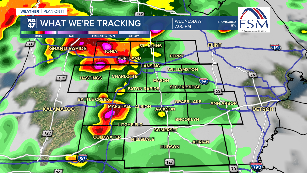
Wednesday will bring our next chance for severe weather. A leftover shower or storm is possible during the morning, but concerns are much higher later in the day.

A potent low pressure system tracking out of the central United States will head directly toward lower Michigan, bringing scattered thunderstorms to our neighborhoods during the afternoon and evening.

The most likely window for severe weather will fall from around 3:00 PM to 9:00 PM. Damaging winds, tornadoes, and large hail will be possible, so make sure to stay weather aware and be ready to head for shelter when storms head your way.
GET YOUR FOX 47 FORECAST HERE
Conditions will take a milder and less humid turn for Juneteenth on Thursday, with highs set to hold in the upper 70s. An isolated shower or thunderstorm will be possible, but most of our neighborhoods should remain dry. We'll roll into the first day of Summer on Friday with a similar forecast, as highs return to the low 80s.

The first weekend of Summer is likely to mark the start of a heat wave. Highs will climb to around 90 degrees on Saturday, along with the continued chance for an isolated thunderstorm. A ridge of high pressure moving over the eastern U.S. will lead us into a few day of sunny skies Sunday through Tuesday, as high through that stretch remain in the low to mid 90s.
Want to learn more about the Weather? Visit the FOX47News Website.
Stay in touch with us anytime, anywhere.
Sign up for newsletters emailed to your inbox.
Select from these options: Breaking News, Severe Weather, School Closings, Daily Headlines and Daily Forecasts.
