
LANSING, Mich. — Overnight:
Dry but cloudy conditions prevail. Temperatures reach an overnight low of about 29°F. However, any areas that are still wet from the freezing rain and rain early will freeze over, and icy conditions could make things hazardous. Please use caution.
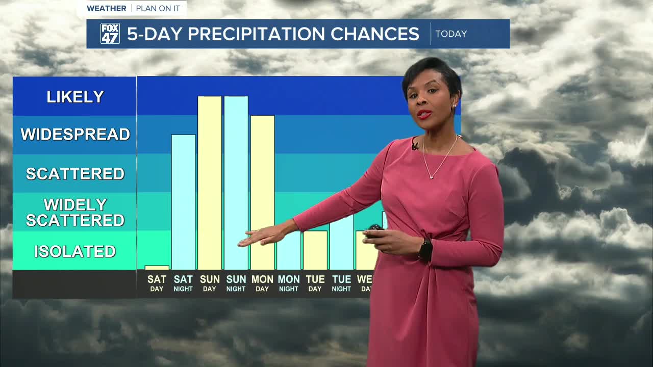
Saturday:
Mostly cloudy conditions and temperatures topping out about 39°F are expected during the day. However, overnight, a strong storm system from the west will move over the Great Lakes and arrive in our area around midnight.
Sunday:
Widespread rain showers dominate the day; however, at night, a strong cold front moves through, which will dramatically drop the temperature, causing the rain to switch over to lake effect snow showers. Additionally, although temperatures on Sunday reach an unseasonable high of about 52°F during the day, the cold front causes temperatures to plummet to about 28°F overnight.
Monday:
Lake effect snow showers continue. Strong winds, gusting in the 40s and possibly 50s at times, will cause visibility issues on the roads. Temperatures are expected to reach highs of about 32°F and a low of 19°F.
Tuesday-Thursday:
Mostly cloudy conditions prevail each day with smaller chances for scattered snow showers. Temperatures should stay in the upper 20s Tues-Wed, then only top about 18°F for Thursday, so bundle up!
Friday:
Cold temperatures continue with highs expected at 18°F, with partly cloudy skies.
Want more FOX 47 News? Here's how you download our Roku app
You can also see the latest news from across our mid-Michigan neighborhoods by liking us on Facebook or following us on X.
