
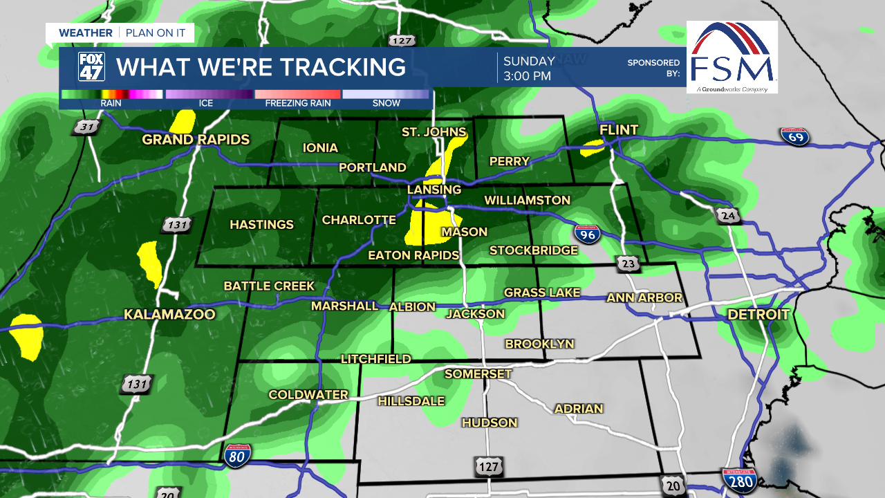
A strengthening area of low pressure will move in over the region today, keeping occasional rain going well into the evening. While the threat of thunderstorms is behind us, winds will be at their strongest as we transition to the back side of the low this afternoon. Winds will pivot into the west-northwest, sustained around 15-25 mph, with some gusts around 40 mph at times.

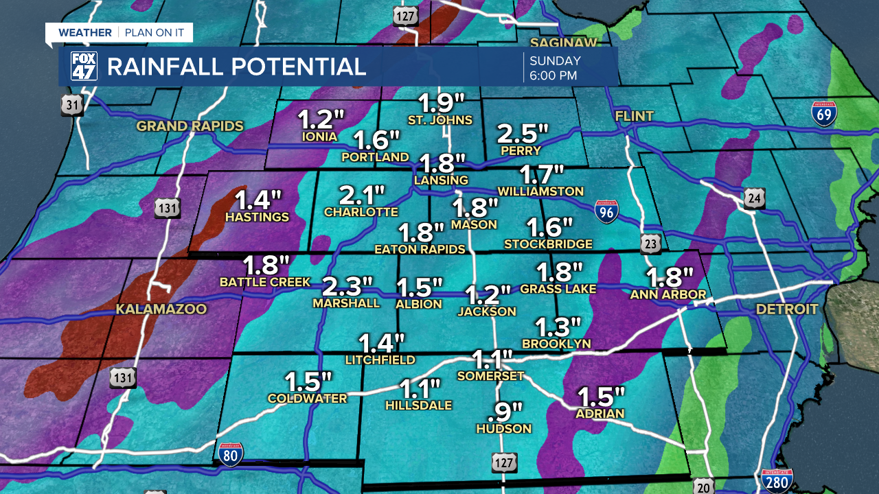
Overall rainfall totals of 1"-2" are still expected across all of our neighborhoods, with locally higher amounts possible. While some ponding on roads is possible in low-lying or poor-drainage areas, widespread significant flooding is not expected. The rain should prove very helpful for our ongoing drought.
Monday gives us a brief chance to catch our breath, with mostly sunny skies and highs in the low 60s. Another disturbance will follow with more showers and gusty winds Tuesday into Wednesday, with this one bringing a sharper cooldown for the balance of next week. Highs Tuesday through Friday will be limited to the low and mid 50s.

Want more FOX 47 News? Here's how you download our Roku app
You can also see the latest news from across our mid-Michigan neighborhoods by liking us on Facebook or following us on X.
