
LANSING, Mich. — Isolated thunderstorms that tracked through some of our neighborhoods earlier this evening will diminish over the next few hours. Clear to partly cloudy skies will take over for the remainder of the night, with one more round of lows in the low 60s.
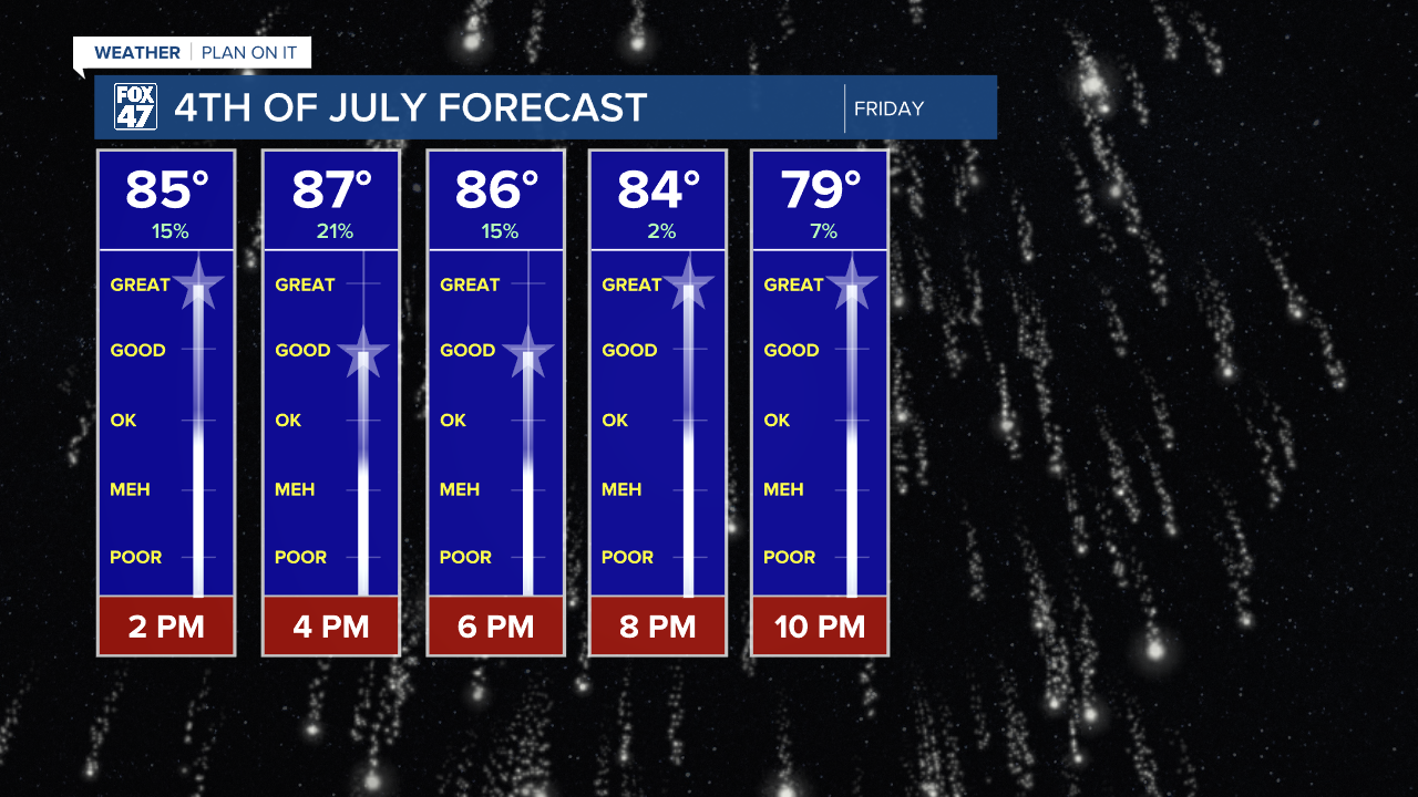
We begin to heat up and turn more humid for Independence Day tomorrow, but our weather is looking good overall for the holiday. We'll see a mix of sun and clouds throughout the day, with the potential for a few more isolated thunderstorms in the afternoon. While this will be something to be on the lookout for if you'll be outside during the day, the storms are expected to be gone in time for fireworks around dusk. Highs will reach the upper 80s, with heat indices climbing into the low and mid 90s, so make sure to stay cool and hydrated.
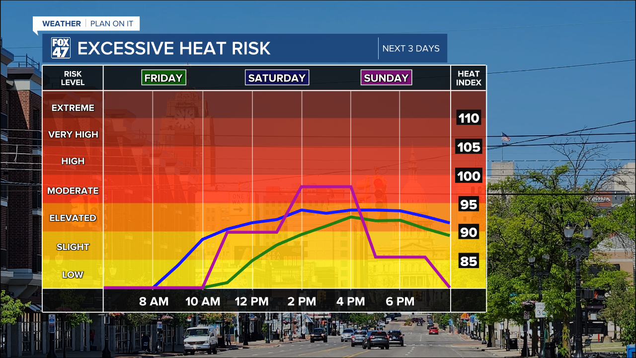
We'll get a break from the storms on Saturday as high pressure reasserts some control over the region. Temperatures will climb into the low 90s under mostly sunny skies though, and heat indices will tip over into the middle and upper 90s.

Thunderstorms will become more likely again on Sunday afternoon ahead of a new cold front. If you are planning on wrapping up your holiday weekend with additional outdoor activities, make sure to have a backup plan in place. The storms are likely to be more numerous and a bit more organized than in more recent days. Highs will top the upper 80s on Sunday before any wet weather rolls in.
GET YOUR FOX 47 FORECAST HERE
Our weather takes a more comfortable turn early next week behind the cold front. Highs will fall back to the low 80s on Monday, with a few leftover morning storms giving way to decreasing clouds. We'll take a nice bite out of the humidity too, and level will remain low through the middle of the week.

Want to learn more about the Weather? Visit the FOX47News Website.
Stay in touch with us anytime, anywhere.
Sign up for newsletters emailed to your inbox.
Select from these options: Breaking News, Severe Weather, School Closings, Daily Headlines and Daily Forecasts.
