


LANSING, Mich. — If you enjoyed the comfortable weather this weekend, get ready for a dramatic change. A strengthening area of high pressure over the Great Plains will expand into the Great Lakes this week, bringing the hottest temperatures we've seen in several weeks. Highs will climb well into the 90s through the middle of the week before a slight cooldown, and the return of rain chances will arrive late in the week.
Dangerous Heat Builds Early This Week
An upper-level ridge, often referred to as a heat dome, will dominate the weather pattern across Lower Michigan through Wednesday.
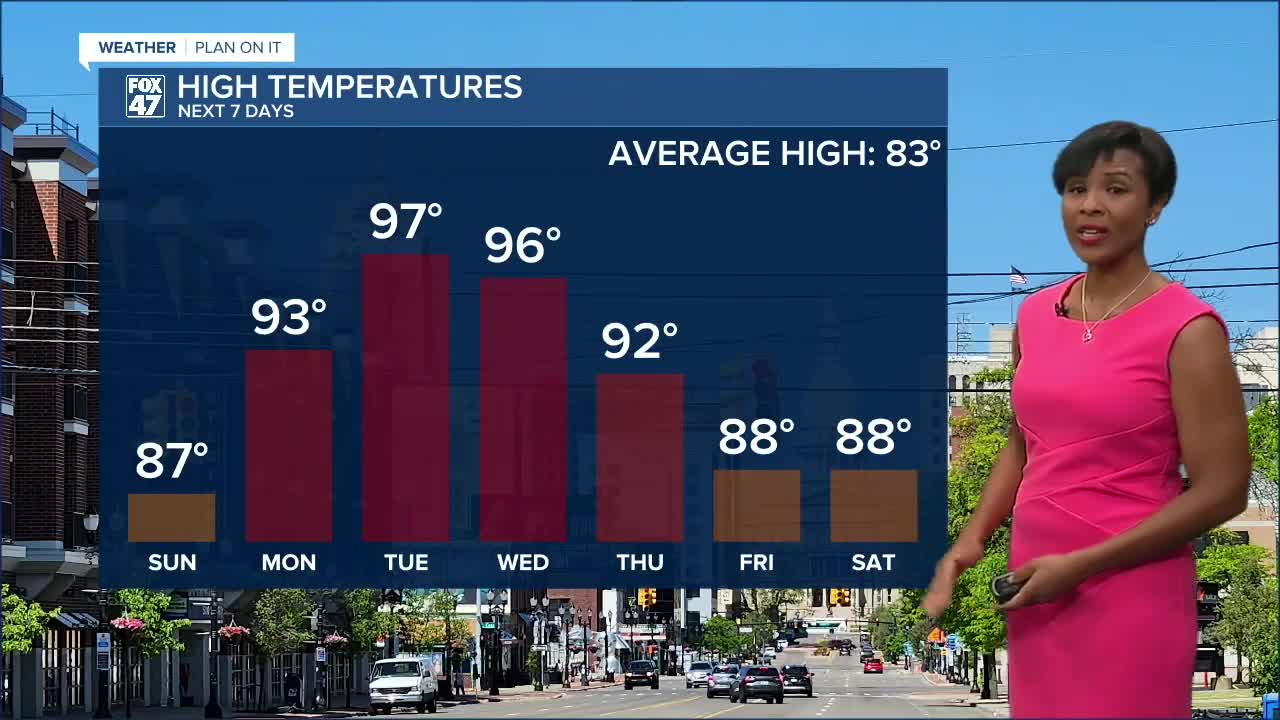
Temperatures will steadily climb each day, with the hottest weather expected on Tuesday, when highs are forecast to reach 97 degrees. Wednesday won't be far behind, with highs in the mid-90s once again.
Forecast highs for the week include:
- Sunday: 87°
- Monday: 93°
- Tuesday: 97°
- Wednesday: 96°
- Thursday: 92°
These temperatures are expected to run 10 to 20 degrees above average for this time of year.
Humidity Will Make It Feel Even Hotter
The heat won't be the only concern.
Humidity levels are expected to increase Tuesday and Wednesday as dew points climb into the lower 70s. That added moisture in the atmosphere will push heat index values close to or above 100 degrees, especially Tuesday afternoon.
While this heat wave may not be quite as intense as the one we experienced recently, portions of Mid-Michigan could still approach Heat Advisory criteria.
If you'll be spending time outdoors this week:
- Drink plenty of water.
- Wear lightweight, light-colored clothing.
- Take frequent breaks in the shade or air conditioning.
- Never leave children or pets inside parked vehicles.
Dry Weather Continues Through Midweek
The same area of high pressure responsible for the heat will also keep skies mostly sunny and rain-free through Wednesday.
That means several consecutive days of dry weather with plenty of sunshine—great news for outdoor plans, but the lack of clouds will also allow temperatures to climb even higher each afternoon.
Rain Chances Return Late Week
Changes begin arriving Thursday as the upper-level ridge weakens and a weather system approaches the Great Lakes.
While Thursday should remain mostly dry for much of the day, scattered showers and thunderstorms become increasingly likely late Thursday into Friday. Forecast confidence continues to improve that rain chances will return by the end of the workweek, although the exact timing remains uncertain.
The added cloud cover and rain chances will also help knock temperatures back into the upper 80s by Friday and Saturday.
7-Day Forecast
Sunday: Sunny. High 87°.
Monday: Sunny and hot. High 93°.
Tuesday: Mostly sunny and very hot. High 97°.
Wednesday: Mostly sunny and hot. High 96°.
Thursday: Mostly sunny. High 92°.
Friday: Chance of showers and thunderstorms. High 88°.
Saturday: Partly sunny with a chance of thunderstorms. High 88°.
Looking Ahead
The biggest weather story this week will be the return of dangerous summer heat. Tuesday and Wednesday will likely be the hottest days, with temperatures pushing the upper 90s and heat index values nearing 100 degrees. After several hot and dry days, the next opportunity for showers and thunderstorms arrives late Thursday into Friday, bringing slightly cooler temperatures as we head into next weekend.
Have a great weather picture or video to share? Send it our way and we may feature it on-air or online!

