
A weak cold front will sweep south across the state and through our neighborhoods tonight. This could stir up an isolated shower or thunderstorms in a few spots, but the vast majority of us will remain dry this evening and overnight. Skies will trend clear as we lose daytime heating, with lows settling into the low 60s by daybreak.

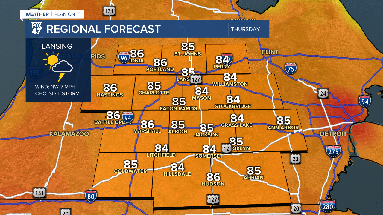
Thursday will offer us similar conditions to what we saw on Wednesday. Mostly sunny skies will have the run of things, with the chance again for a few pop-up showers or storms in the afternoon and evening. Temps will remain very warm in the mid 80s, but humidity will hold in check for one more day.

Heat builds and humidity starts to climb just as we arrive at independence Day on Friday. We'll maintain the chance for pop-up showers or thunderstorms later in the day, but things should be in good shape for barbecues and fireworks in the evening. Keep cool and stay hydrated if you'll be spending time outdoors, with highs headed for the upper 80s. Add in the humidity, and heat indices are likely to climb into the low to mid 90s.
GET YOUR FOX 47 FORECAST HERE
Heat and humidity build a bit more on Saturday, with highs hitting the low 90s. Heat indices are likely to climb into the upper 90s, so it will be a sweltering day under partly cloudy skies. Pop-up showers and storms will remain possible, so we could pick up some natural cooling here and there, but be ready to head for cover. An approaching cold front brings a better chance for storms on Sunday, with one more day of highs in the upper 80s.

Things turn more comfortable behind the front for the first half of next week. Highs will scale back to the low 80s Monday through Wednesday, with plentiful sun before the chance of storms returns midweek.
Want to learn more about the Weather? Visit the FOX47News Website.
Stay in touch with us anytime, anywhere.
Sign up for newsletters emailed to your inbox.
Select from these options: Breaking News, Severe Weather, School Closings, Daily Headlines and Daily Forecasts.
