
LANSING, Mich. — Clouds will continue to increase overnight as a small disturbance sweeps in from across Lake Michigan. While most neighborhoods will remain dry, a few light showers will be possible in our northern communities closer to daybreak. Lows tonight will be chilly in the mid 40s, with light SSE winds at 3-6 mph.
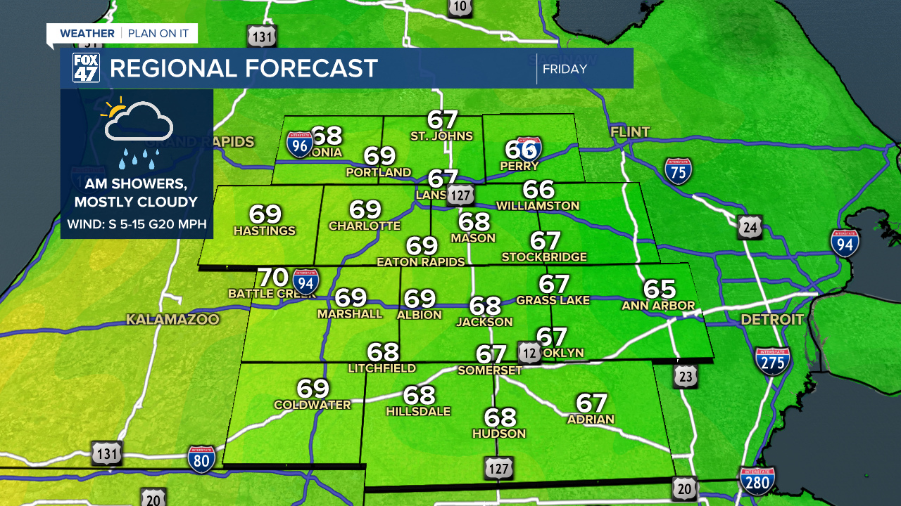
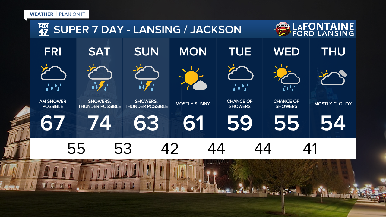
Leftover light showers could make for a few wet spots on the morning commute Friday, but this isolated wet weather will wrap up by midday. Mostly cloudy skies will linger for the remainder of the day as highs moderate a bit into the upper 60s. Friday will be a touch breezier as well, with southerly winds picking up to 5-15 mph.

This weekend will be a bit of a roller coaster ride in the temperature department, but wet weather will be a common fixture. A warm front lifting across the state on Saturday will elevate temperatures to the mid 70s in the afternoon, as returning clouds give way to scattered showers and possibly a few thunderstorms. If you have outdoor plans later in the day, make sure to incorporate some rain gear, and keep it handy if you'll be heading out on Sunday as well.

Rain become more widespread and steady on Saturday night, likely accompanied by a few more rumbles of thunder in advance of a cold front. Leftover showers will continue on Sunday as the cold front and an area of low pressure slowly move across the state. The showers will be more intermittent during the day, but plan on encountering some wet weather. Highs Sunday will turn cooler in the low 60s.
GET YOUR FOX 47 FORECAST HERE
This will kick of a stretch of gradually chiller weather as we head into next week. We'll start the new work week with mostly sunny skies on Monday and highs in the low 60s. Showers return with a new disturbance Tuesday and Wednesday, with high continuing to trend cooler into the mid 50s by midweek.
Want more FOX 47 News? Here's how you download our Roku app
You can also see the latest news from across our mid-Michigan neighborhoods by liking us on Facebook or following us on X.
