


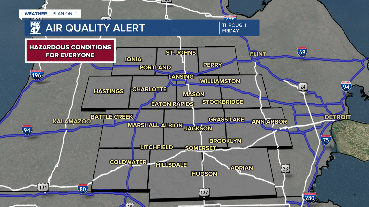
AIR QUALITY ALERT remains in effect statewide through much of Friday. Hazardous levels of smoke will continue to hover over the region, posing a risk to everyone, regardless of health status. Stay indoors as much as possible and keep windows closed.
Northwesterly flow continues to send thick plumes of smoke across Michigan, originating from wildfires in southern Canada. No improvement is expected overnight, but the weather itself will remain quiet. Lows will fall to the mid 60s, with calm winds allowing the air to stagnate.

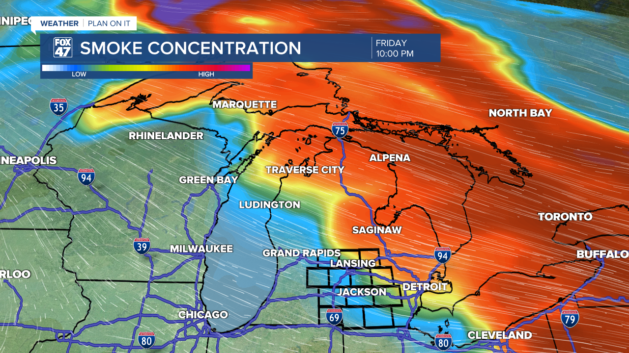
Thick smoke will remain in place over the area on Friday morning, so you'll want to hold off on that early walk. Air quality will remain especially unhealthy through midday, but a slow improvement is expected during the afternoon and into Friday night. A warm front sweeping in from Wisconsin will pivot our winds toward the southwest, which in turn will begin to push the smoke away to the north and east. Conditions should be significantly better by evening, but we'll have something else to keep an eye out for.
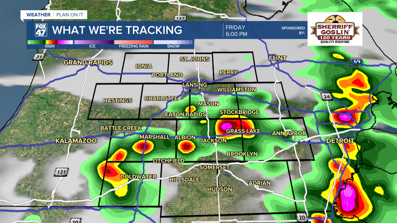
The warm front is likely to fire off a round of hit-or-miss showers and thunderstorms in the afternoon and early-evening. Severe weather is not expected, but we'll still be on the lookout for heavy downpours and gusty winds. Highs will top the low 90s for one more day, then a stretch of milder weather will take over.
Skies will clear out on Friday night along with the smoke, while lows settle in the low 70s. It will finally be safer to take a deep breath again, but it's starting to look like that relief won't last long.
GET YOUR FOX 47 FORECAST HERE
Here's the rub. Friday's warm front will be followed by a new cold front and area of low pressure on Saturday afternoon. Winds are expected to pivot back toward the northwest in the wake of the front and as the low moves east through the Great Lakes. That means more smoke will likely be pushed back across the state by Saturday evening. Whether we reach the same hazardous levels of air quality remains to be seen, but be prepared for conditions to deteriorate again.

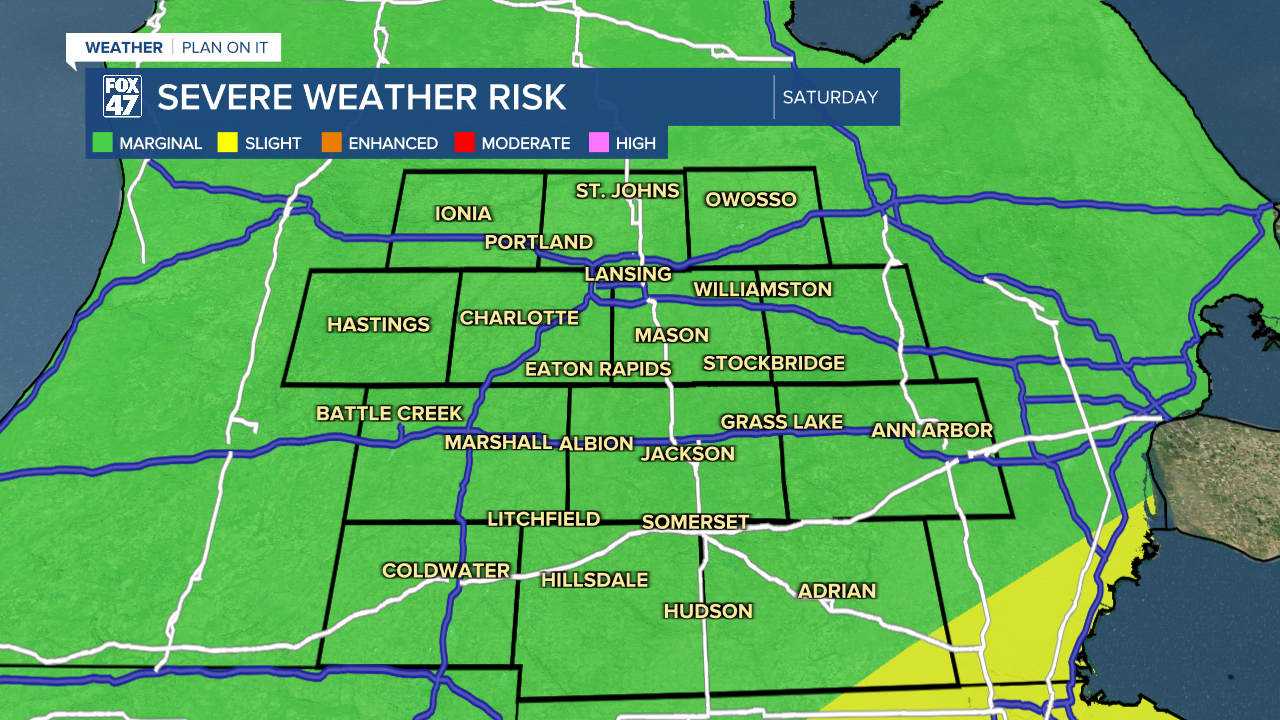
Saturday's cold front will also stir up some hit-or-miss afternoon storms on Saturday, and they'll bring an isolated risk for severe weather with them. Damaging winds are the main concern along with torrential downpours and frequent lightning. Highs Saturday will hold in the upper 80s.
Smoke notwithstanding, mostly sunny skies and lower humidity are expected on Sunday as highs dip a bit further to the mid 80s. A few storms will be possible again on Monday and Tuesday followed by drier weather for the middle of the week. We'll enjoy some more comfortable weather too, with highs hovering in the upper 70s to low 80s.

Have a great weather picture or video to share? Send it our way and we may feature it on-air or online!

