
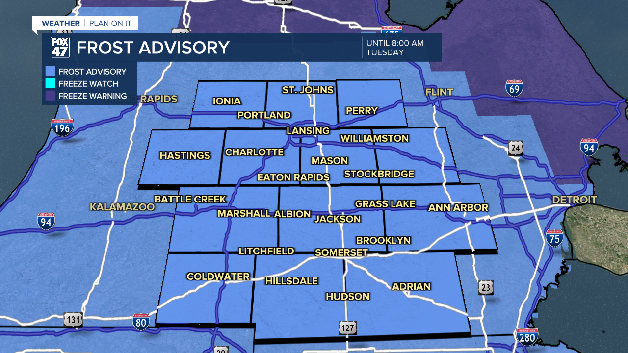
FROST ADVISORY in effect until 8:00 AM Tuesday. Make sure to protect sensitive outdoor plants, and brings pets indoors for the night.
Scattered clouds will dissipate this evening, leaving us with mostly clear skies for the balance of our Monday night. A small pocket of high pressure hovering over the region will reinforce this latest shot of cooler air, allowing lows to dip to the middle and upper 30s. Areas of frost are possible by daybreak.
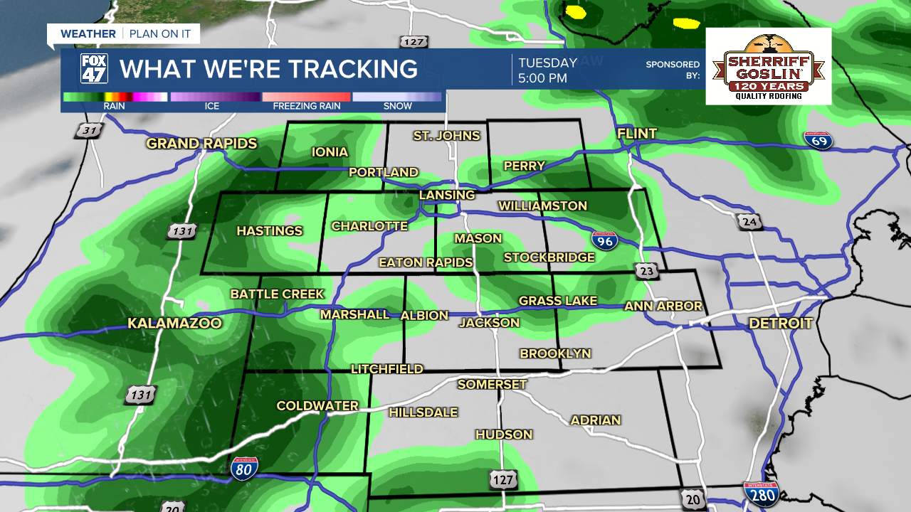
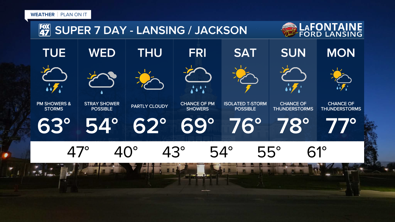
A warm front sweeps in from the northern Plains on Tuesday, leading to increasingly cloudy skies but also allowing for some slightly milder air. Highs will head for the low 60s, with scattered showers developing in the afternoon. A few rumbles of thunder cannot be ruled out, especially later Tuesday evening when a cold front passes through the region.
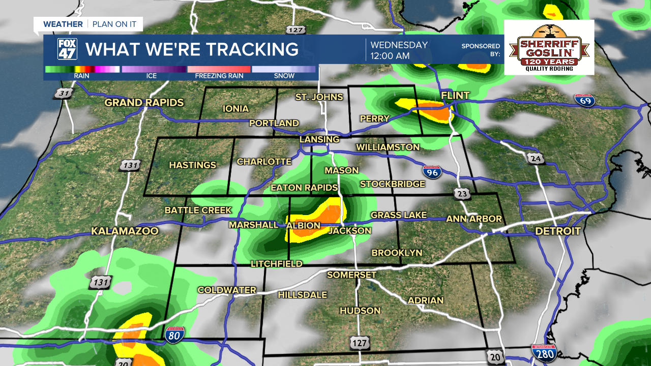
One more shot of cooler air spills in behind the front on Wednesday, taking highs back to the low and mid 50s. With a small upper-level trough also digging in, we'll remain stuck under mostly cloudy skies with the chance for a stray shower or two. This will be the last cool day this week before a significant warmup takes shape as we head toward the weekend!
GET YOUR FOX 47 FORECAST HERE
Thursday treats us to partly cloudy skies with temperatures inching their way back to the low 60s. We'll still be around 5-8 degrees below average, but it's a step in the right direction. One we will continue to build momentum on for Friday when highs climb closer to 70 degrees. We'll cap off the work week with the chance for late-day showers, with partly to mostly cloudy skies otherwise.
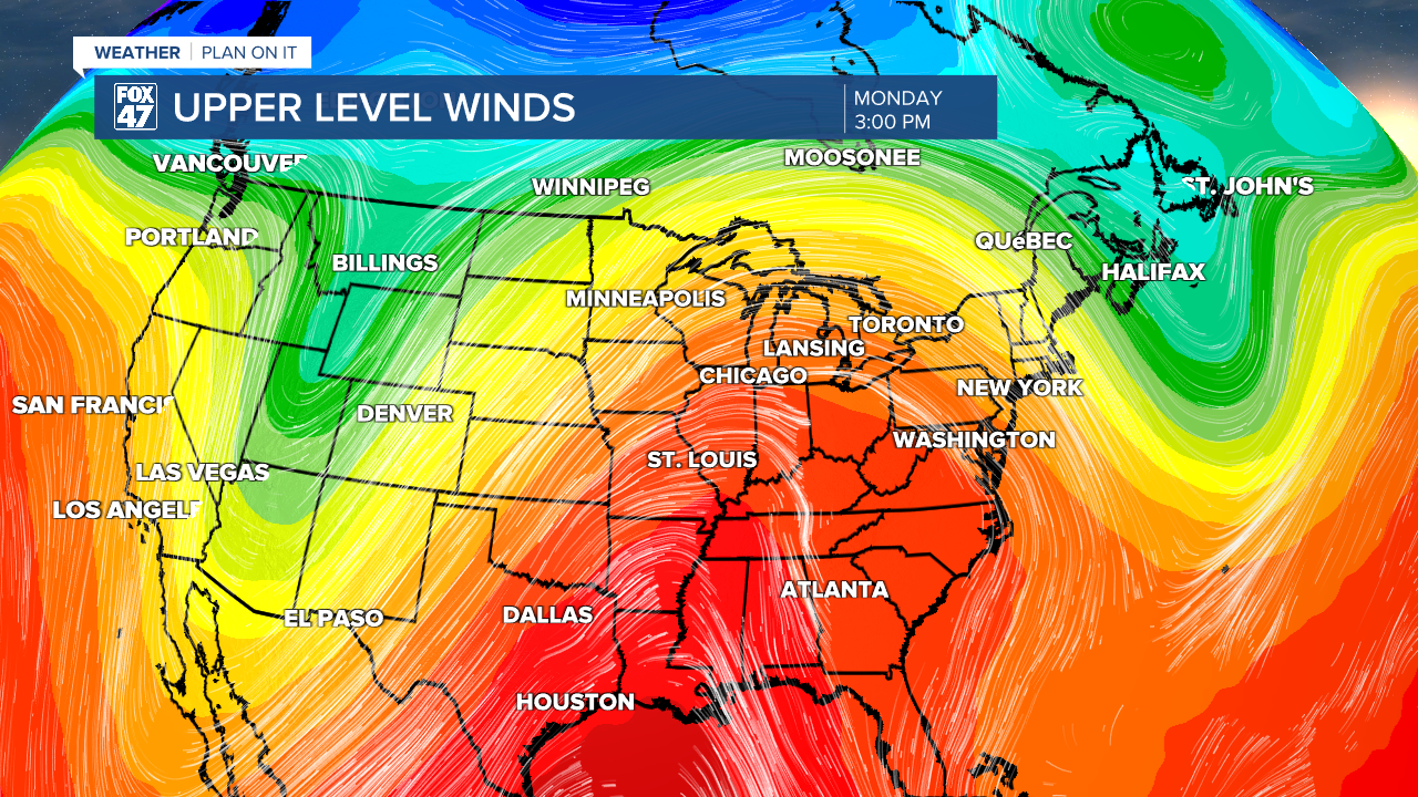
The weekend is when the getting really gets good! A ridge of high pressure over the west-central United States will begin to shift east, with a surge of warmth coming our way. Highs will jump to the middle and upper 70s on Saturday and Sunday, with the chance for a few showers and thunderstorms.
Have a great weather picture or video to share? Send it our way and we may feature it on-air or online!

