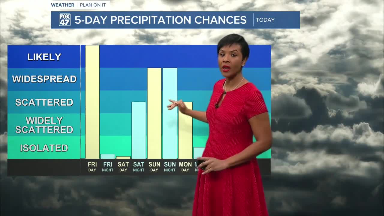

LANSING, Mich. — Overnight: Freezing rain will start popping up in some neighborhoods around 2:00 and become more widespread by 5:00 a.m. A winter weather advisory is in effect from Friday at 5:00 a.m. until 4:00 p.m. due to possible hazardous road conditions and ice as a result of the freezing rain. Power outages cannot be ruled out as ice freezes. Temperatures are expected to reach an overnight low of 29°F with winds out of the SE at 11mph, but gusting in the low 20s at times.
Friday: Widespread freezing rain dominates the day and could cause ice and difficult conditions on the roads. Temperatures should reach a high of 37°F and lows of about 30°F. Mostly neighborhoods should dry out by 4:00 p.m., then cloudy conditions prevail.
Saturday: Mostly cloudy conditions and temperatures topping out in the low 40s prevail during the day. However, overnight rain moves in and stick aroud into Sunday.
Sunday: Widespread rain showers dominate the day; however, at night, when the temperatures drop, rain switches over to lake effect snow showers. Additionally, an upper-level moving over the Great Lakes will send temperatures soaring into the upper 40s and possibly low 50s for highs, and also bring on the lake-effect snow through Monday.
Monday: Expect lake-effect snow showers during the day and temperatures of about 30°F.
Tuesday-Thursday: Mostly cloudy conditions prevail each day with smaller chances for scattered snow showers, particuldary Wednesday, New Year's Eve. Temperatures should stay in the upper 20s all three days, so bundle up!
Want more FOX 47 News? Here's how you download our Roku app
You can also see the latest news from across our mid-Michigan neighborhoods by liking us on Facebook or following us on X.
