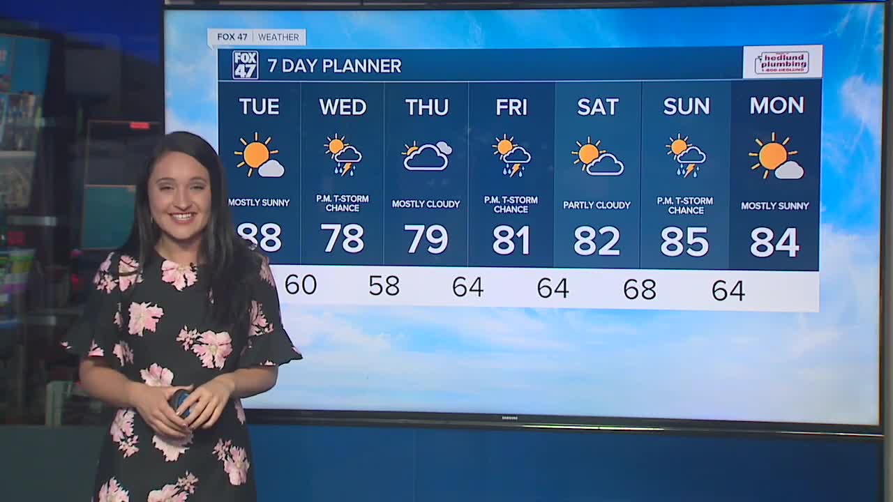


LANSING, Mich. — The dry weather streak continues tonight, with hazy skies. Wildfires in the Western United States and Canada continue to send smoke into mid-Michigan, riding our upper-level jet stream and prevailing westerly winds. Overnight lows fall into the low 60s. On Tuesday, a cold front will drop in from the north and spark showers and thunderstorms during the afternoon. Mid-Michigan may get a chance to see rain showers and a few strikes of lightning. Following the passage of this front, look for slightly cooler and less humid conditions on Wednesday. Just as quickly as the cooler air moves in, the warm air will be back on Thursday with highs in the 80s. Afternoon showers and storms will also be possible on Thursday as a system approaches. We are also keeping our eye on a system arriving Saturday evening, departing Sunday morning.
TONIGHT: Mostly clear. Lows in the lower 60s. West winds at 5 to 10 mph.
TOMORROW: Partly cloudy with a smoky haze. Chance of showers and storms near and east of US-131 by late afternoon/early evening. Highs in the low/mid-80s. West winds at 5 to 15 mph.
WEDNESDAY: Partly cloudy. A bit cooler and drier airmass arrives. Highs in the upper 70s. North to northwest winds at 5 to10 mph.
THURSDAY: Partly cloudy with afternoon scattered showers and thunderstorms. Highs in the low 80s.
FRIDAY: Partly cloudy. Highs in the low 80s.
SATURDAY: Scattered showers and a few thunderstorms in the afternoon. Highs in the low 80s.
Want to learn more about the Weather? Visit the FOX47News Website.
Stay in touch with us anytime, anywhere.
Sign up for newsletters emailed to your inbox.
Select from these options: Breaking News, Severe Weather, School Closings, Daily Headlines and Daily Forecasts.
