
LANSING, Mich. — The return to work and school following the holidays was made a little easier for us by pleasant weather on Monday. Despite cloudy skies, conditions remained dry and we saw temperatures climb above average in the middle to upper 30s.
With a bit more moisture settling into our air mass, patchy fog will develop tonight as lows dip only a few degrees into the low 30s. A few showers will begin to creep in just before daybreak as a new disturbance moves in from the northern Plains.
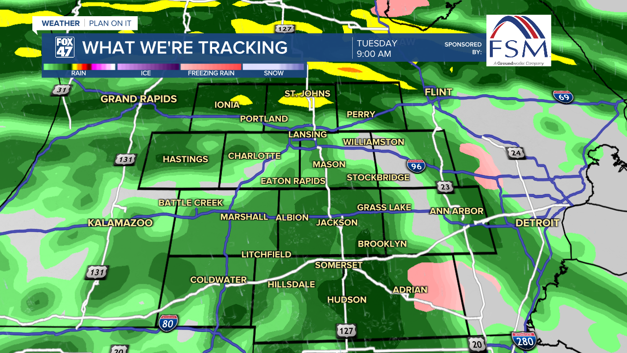
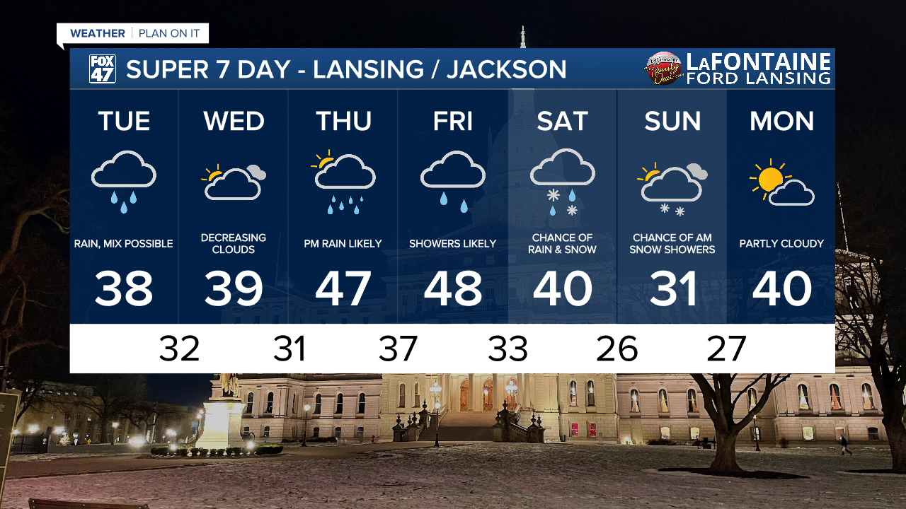
Spotty showers will quickly develop into a widespread, steadier rain on Tuesday morning. Expect wet roads to become increasingly common throughout the morning commute, with the potential for some spotty freezing rain at the onset while temperatures hover around 32 degrees. Rain will become more intermittent after midday, with showers lingering until about midnight. Highs will remain in the above-average column, reaching the upper 30s with light NW winds at 5-10 mph.

Wednesday gives us a chance to dry out for the middle of the week thanks to a region of high pressure moving through the lower Ohio Valley. This will keep southwesterly wind flow in place, leading to another day of mild highs in the upper 30s to around 40 degrees.
GET YOUR FOX 47 FORECAST HERE
A more potent storm system tracks out of the central U.S. on Thursday. We'll start the day with some morning sunshine, followed by increasing clouds in the afternoon. Showers developing after sunset will developing into steady rain overnight. The system will bring a surge of milder air in with it, pushing Thursday's highs into the upper 40s. Showers will linger into the day on Friday as the system tracks through the Great Lakes. We'll sneak in one more round of upper 40s before cooling a bit behind the system this weekend.
Want more FOX 47 News? Here's how you download our Roku app
You can also see the latest news from across our mid-Michigan neighborhoods by liking us on Facebook or following us on X.
