
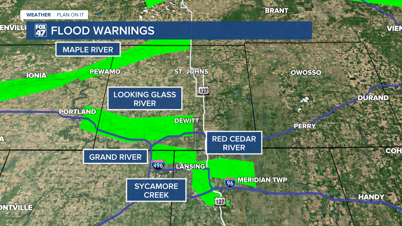
FLOOD WARNINGS remain in effect for several area rivers and creeks as water levels rise in response to this week's heavy rain and thunderstorms. Get the latest warning information here.
Scattered showers and thunderstorms will continue to move through our neighborhoods early this evening, with a low chance for an isolated severe storm east of US-127. Storms could produce heavy downpours, gusty winds, and small hail before tapering off after 8:00 PM.
GET YOUR FOX 47 FORECAST HERE
Skies will clear for a few hours between 10:00 PM and 2:00 AM before a combination of low clouds and areas of fog settle in. The fog could be locally dense, so be prepared for reduced visibility if traveling overnight or Friday morning. Lows will run slightly cooler, falling to the low 50s with calm winds.
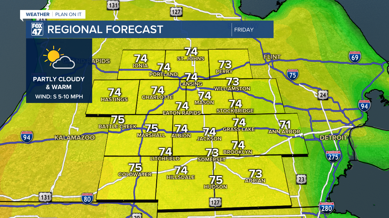
Friday gives us a sorely-needed break from this week's repeated bouts of heavy rain and thunderstorms. Morning fog is expected to dissipate quickly, giving way to partly to mostly sunny skies for the afternoon. We'll even keep the warmer temperatures around, with highs set for the mid 70s.
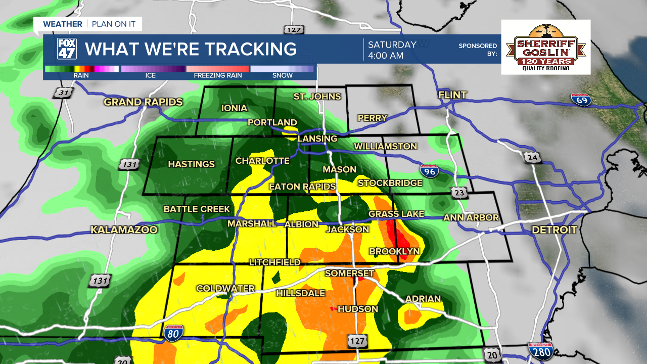
Showers and thunderstorms return late Friday night into Saturday morning ahead of a new cold front. Another round of heavy downpours is expected, but severe weather potential is low and mostly confined to the west side of the state. Storms will taper off on Saturday morning, giving way to some clearing in the afternoon. Highs will be held to the low 60s, with the front ushering in a shot of chilly air for the second half of the weekend.

Highs will take a steep dive back to the mid 40s with variably cloudy skies on Sunday, marking the end of our week-long stretch of above-average warmth. The dip will be brief, but it will take us a bit to get back to the 70s. Highs will return to the 50s and 60s Monday through Wednesday, finally getting back to the low 70s on Thursday.
Have a great weather picture or video to share? Send it our way and we may feature it on-air or online!

