
FREEZE WARNING in effect from midnight until 9:00 AM Thursday for the following counties: CALHOUN, CLINTON, EATON, INGHAM, IONIA, JACKSON.
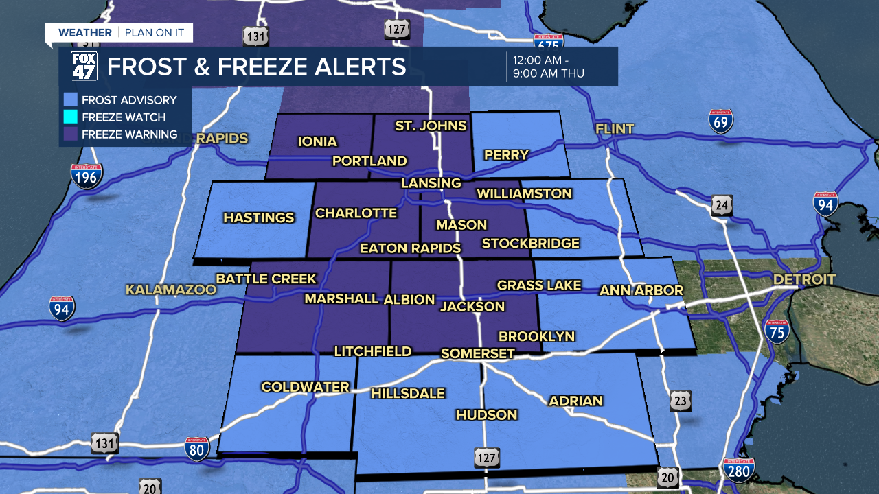
FROST ADVISORY in effect from midnight until 9:00 AM Thursday for the following counties: BARRY, BRANCH, LENAWEE, LIVINGSTON, SHIAWASSEE, WASHTENAW.
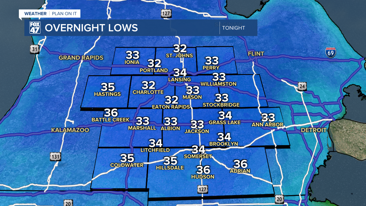
Take some time this evening to cover up your plants or bring them inside, and make sure your pets are brought in for the night, too! A pocket of chilly high pressure settling over the Great Lakes will keep skies clear tonight, while also locking in some unseasonably cold air. Lows will fall to the low and mid 30s across our neighborhoods overnight, leading to the first widespread frost of the season. For some, it may even rise to a full freeze.

Sunny skies stay in control on Thursday as high pressure begins to slide to the east of our area. Following the morning frost, we'll remain on the cooler side with another afternoon of highs in the low 60s.
GET YOUR FOX 47 FORECAST HERE
A small disturbance tracking south from Canada will bring some changes our way on Friday. While most of the daytime period will see a mix of clouds and sunshine, clouds will increase around the evening commute, bringing a few showers in with them around sunset. Highs Friday will inch slightly higher into the mid 60s.

The rain will not be as significant as what fell on Monday night and Tuesday, but occasional showers will continue through Friday night and are now expected to linger into much of Saturday. Mostly sunny skies remain intact for Sunday though, making for a beautiful second half of the weekend. After holding in the mid 60s on Saturday, highs will climb to the upper 60s on Sunday.
Want more FOX 47 News? Here's how you download our Roku app
You can also see the latest news from across our mid-Michigan neighborhoods by liking us on Facebook or following us on X.
