

EXTREME HEAT WARNING in effect until 8:00 PM Thursday. Daily heat indices around 105° are expected, with no significant relief expected at night.
HEAT SAFETY TIPS BELOW


An expanding ridge of high pressure has spread across the Great Lakes, allowing a surge of heat and humidity to pour into the area. Temperatures already topped the low 90s on Monday with heat indices reaching 100 degrees, and it will be getting even hotter through the midweek period.
For tonight, partly cloudy skies will remain in place with any significant chance for thunderstorms running north of Mid-Michigan. It will feel like a sauna, with lows only falling to the mid 70s amid the tropical levels of humidity. A south winds at 5-10 mph won't offer any real comfort, either.
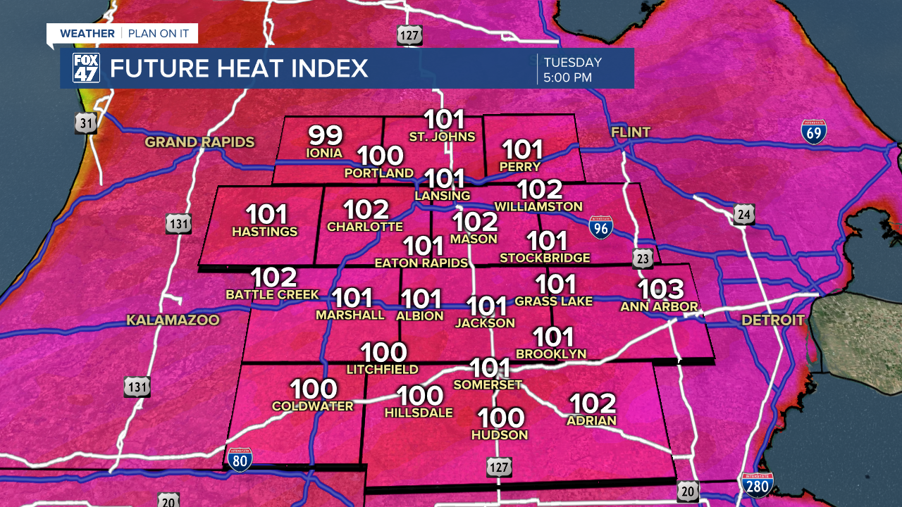
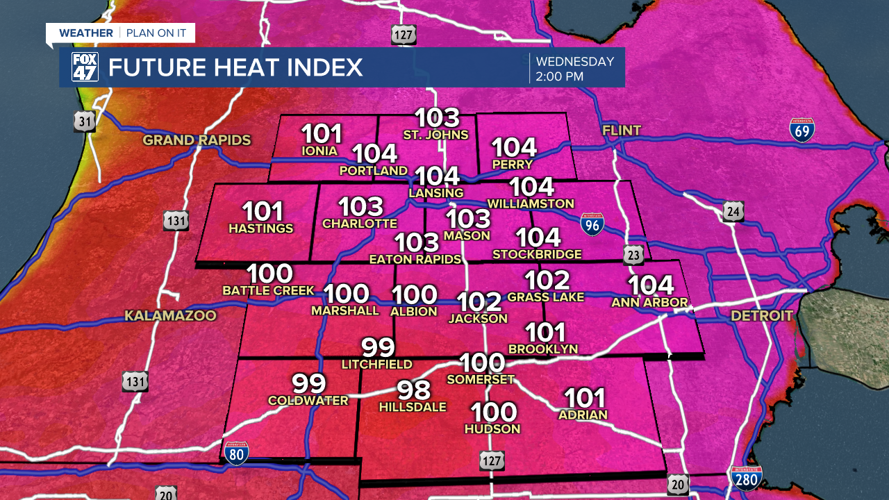
With a warm front lifting north of the region on Tuesday, temperatures and heat indices will climb even higher. With the ridge of high pressure pushing the main storm track north of the region, we will bake under sunny skies throughout the day. Highs will climb into the mid 90s, with heat indices peaking around 105° in the afternoon and early-evening. Lows will only fall to the mid 70s, giving us no significant overnight relief. Expect nearly-identical conditions on Wednesday.

Thursday at least introduces a slightly better chance for isolated thunderstorms to cool us off, but it's not expected to amount to much. It will be another day of highs in the mid 90s with the real feel climbing closer to 105° at times.
The high pressure ridge flattens out a bit going into the holiday weekend, allowing some slightly milder air to settle in from the north. The emphasis is on 'slightly' because highs will still top the upper 80s to low 90s Friday through Sunday, with no significant break in the humidity. We'll also be at an increased risk for pop-up storms, possibly adding some natural fireworks to the festivities on Independence Day.

Have a great weather picture or video to share? Send it our way and we may feature it on-air or online!

