
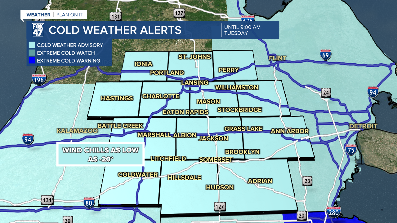
COLD WEATHER ADVISORY in effect until 9:00 AM Tuesday. Wind chills as low as -20° are possible tonight into Tuesday morning, making frostbite possible on exposed skin in as little as 30 minutes.
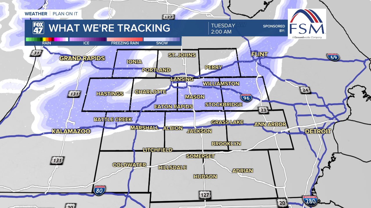
If you're finding yourself exhausted with the last week of frigid temperatures and repeated bouts of snow, the forecast over the next few days is not likely to help. Isolated snow showers this evening will become more widespread overnight thanks to a new clipper system moving through the Great Lakes.
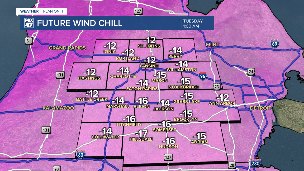
Extreme cold will be digging in again, too. Lows will fall to the low single-digits in most neighborhoods, with brutal wind chills between -10 and -20 degrees.
GET YOUR FOX 47 FORECAST HERE
Lake effect snow showers continue throughout most of the day Tuesday, keeping roads messy. Activity will diminish after 4:00 PM, paving the way for some clearing skies in the evening and overnight. Snowfall amounts over the next 24 hours will hover around 1" to 1.5" in most neighborhoods, with some lighter amounts east of US-127.

The chance for snow showers continues on Wednesday and Thursday before giving way to dry weather Friday through Sunday. Highs will remain locked in the teens through the upcoming weekend, with a stretch of sub-zero lows Wednesday night through Saturday night. Thursday night will be especially cold, with lows heading for the negative teens again.
Want more FOX 47 News? Here's how you download our Roku app
You can also see the latest news from across our mid-Michigan neighborhoods by liking us on Facebook or following us on X.
