

LANSING, Mich. — All of our area saw some rainfall yesterday with passing showers and storms, however, the severe threat was a bit of a bust. As the cold front sags south of the state today, we will be drying up with highs only reaching the lower 80's with gradually decreasing cloud cover.

WATCH THE FULL FORECAST BELOW
Lansing was able to observe .26" of rainfall from yesterdays round of precipitation. This brings our monthly rainfall total in Lansing for July up to 1.32". This is well below average for this time of year and we only have one day left in July where we are tracking the chances for showers and storms.
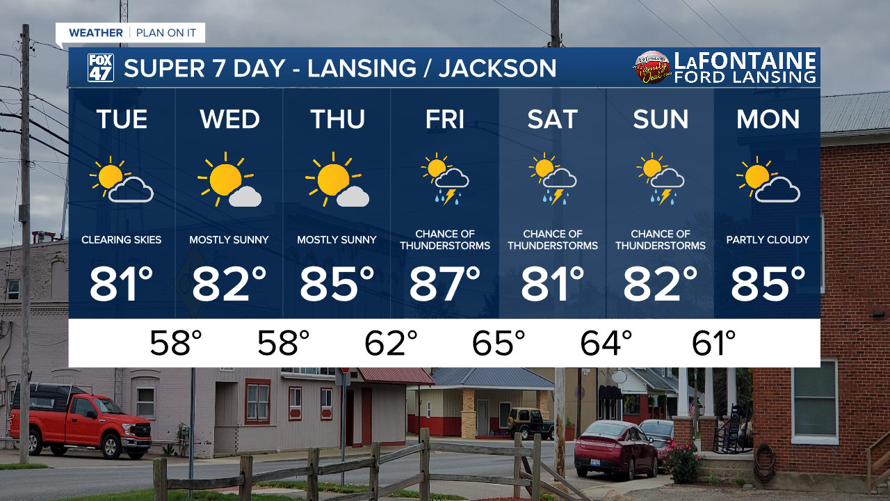
We will stay dry Tuesday through Thursday as high pressure helps to clear our skies allowing for lots of sunshine. We will remain a bit breezy, however, with gusts out of the north ranging from 20-25 mph Tuesday as well as Wednesday.

An upper level low will enter the region late this week with smaller scale features allowing for the return of showers and storms as early as Friday afternoon and taking us into the weekend both Saturday and Sunday.

It's still a bit too early to talk potential severe impacts with these rounds of storms, however, we will see temperatures warm back into the upper 80's Friday with humid conditions also returning. Make sure to grab the umbrella for any weekend plans. We are expecting to dry up again as we start a new week next week.
Have a great weather picture or video to share? Send it our way and we may feature it on-air or online!

