
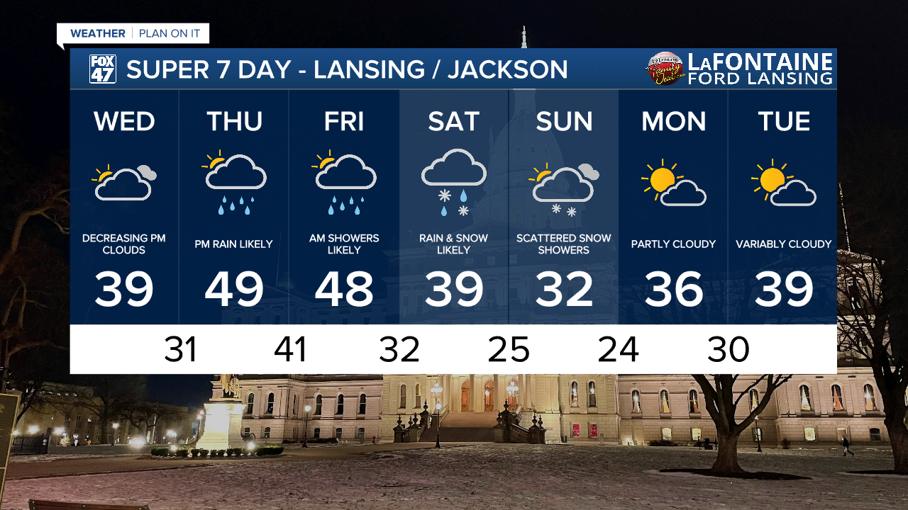
LANSING, Mich. — Tuesday's dreary conditions will remain in place across our neighborhoods tonight. Areas of fog will linger, and could be locally dense. A final wave of rain and snow showers will also sweep through the region between 8:00 PM and 2:00 AM, further complicating our already-difficult travel conditions. Temperatures will hover in the mid 30s throughout the night, keeping the threat of ice to a minimum.

Wednesday offers up a welcome break from what will continue to be an active weather pattern going into the weekend. Any leftover fog will dissipate during the morning, with mostly cloudy skies expected through midday. Clouds will decrease in the afternoon, allowing us some breaks of sun as highs continue to hover in the upper 30s.
GET YOUR FOX 47 FORECAST HERE
Thursday and Friday throw our next storm system at us, as an area of low pressure rolls off of the Rockies and tracks toward the Great Lakes. Mostly cloudy skies and a little sun on Thursday morning will give way to increasing clouds for the afternoon. Most of the daytime hours will remain dry, with the first spotty showers expected to roll in around or just after the evening commute. Rain fans out across the region on Thursday night, and could be heavy at times. Showers will persist into Friday morning, but are expected to taper off by afternoon.

By storm's end, most neighborhoods are in line to pick up half-an-inch or more of rainfall. Flooding is not expected to be an issue, but some ponding of roads on Friday morning will be possible, especially when combined with any snow melt still going on. We get one upside out of this system, though. Highs on Thursday and Friday will climb to the upper 40s, with an outside chance for a few neighborhoods to get into the low 50s.

Friday afternoon and Friday night are about all we'll get for a break before another storm system tracks in from the central Plains on Saturday. Another round of rain is expected with this system, and it may mix with snow in some areas later in the evening. Highs will start the weekend in the upper 30s, but will dip to the low 30s as the system begins to depart on Sunday. This will likely leave us with scattered snow showers for the second half of the weekend, but does pave the way for a couple of quiet days Monday and Tuesday.
Want more FOX 47 News? Here's how you download our Roku app
You can also see the latest news from across our mid-Michigan neighborhoods by liking us on Facebook or following us on X.
