
LANSING, Mich. — Today will be a fairly quiet day for most of Mid-Michigan with seasonable temperatures in the lower 30s. Gusty west-northwesterly winds will allow for a few lake effect snow showers to drift into our far southwestern counties, but the majority of Mid-Michigan will just be cloudy. Any lake effect snow showers that we see today will taper off tonight and skies will clear by daybreak on Tuesday. Temperatures will drop into the upper teens as the skies clear out. Tuesday will be partly cloudy with highs near 30.
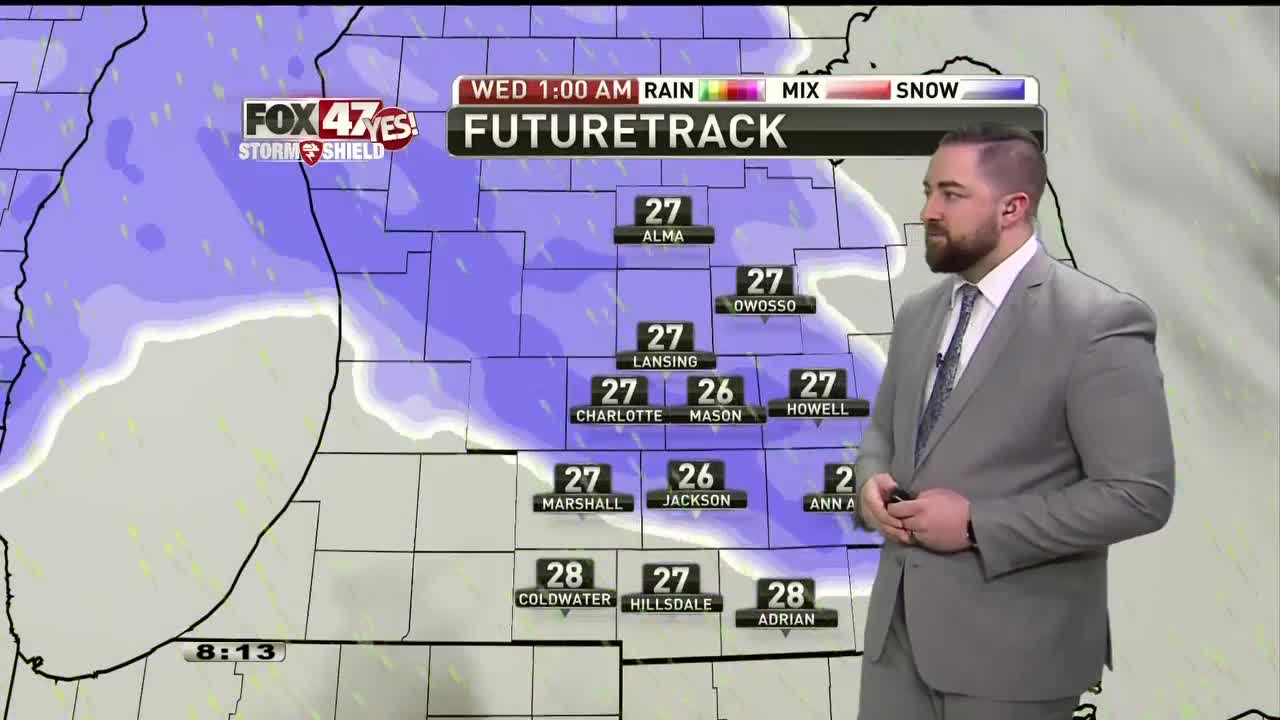
A midweek system will bring the chance of both snow and rain to the area. At this point, it looks like light snow will spread into the area Tuesday night, and then as temperatures rise into the 40s on Wednesday, this snow will transition to rain showers. This will be a system to watch over the next day or so as it approaches, but it looks like we may pick up some light snow accumulations, especially north of I-94.
We’ll quiet things down on Thursday for New Years Eve with mostly cloudy skies and temperatures topping out in the mid 30s. Another round of precipitation will move in on Friday, bringing the chance of rain and snow to the area with highs in the mid 30s.
-Meteorologist Caleb Meute
Want to learn more about the Weather? Visit the FOX47News Website.
Stay in touch with us anytime, anywhere.
Sign up for newsletters emailed to your inbox.
Select from these options: Breaking News, Severe Weather, School Closings, Daily Headlines and Daily Forecasts.
