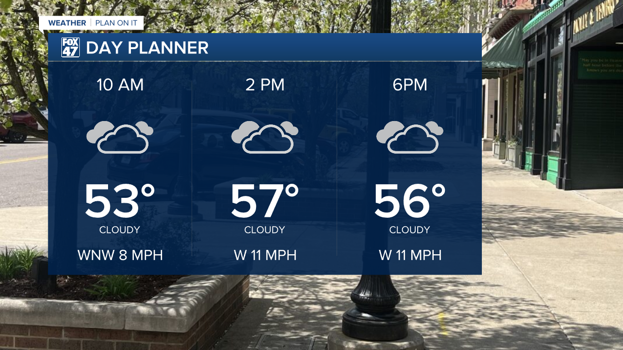
LANSING, Mich. — Following showers and storms from Monday, a cold front advancing through the region will aid in dropping temperatures across our neighborhoods today. By the afternoon hours, we could see temperatures in the mid to upper 50's with chances for tame rain showers with no major impacts.
WATCH THE FULL FORECAST BELOW
Showers shouldn't amount to much today as the influence of warmer moist air moves off east. We will be left with lots of cloud cover today which will continue into Wednesday and Thursday as well with some clearing during the AM hours. Enjoy the sunshine once it rises.

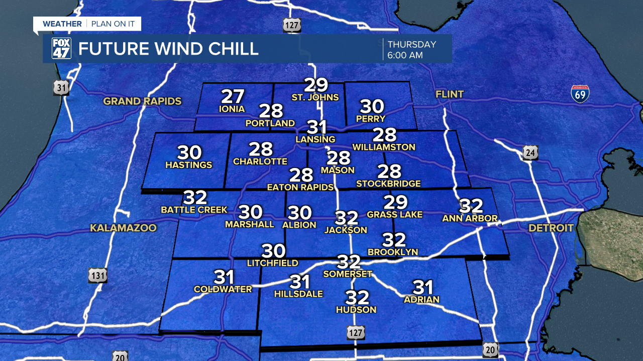
Temperatures cool as we remain influenced by an upper level area of low pressure that is helping usher in cooler temperatures across our neighborhoods. We will definitely be feeling this cool down in the morning hours where lows dip below freezing beginning tonight possible with lows in the upper 30's and possibly staying in the lower 40's.
We are more watching Wednesday into Thursday morning where lows drop to the mid 30's with feels like temperatures in the upper 20's/lower 30's. Grab that winter jacket when heading out the door. Favorable conditions for frost include calm winds and clear skies. At the moment, we are tracking weaker winds with clear skies Thursday morning. Make sure to protect your plants Wednesday night by covering them up or bringing them inside.
Once we reach the weekend, temperatures will warm back up across our neighborhoods into the 60's. This will include Mother's Day, but we will have to watch out for some shower chances beginning Friday and lasting into early next week.

Have a great weather picture or video to share? Send it our way and we may feature it on-air or online!

