
LANSING, Mich. — If you've been enjoying the recent stretch of mild temperatures, you're in luck. A persistent northwest flow pattern will keep temperatures running below normal through much of next week, with highs generally staying in the 70s. While there will be several opportunities for rain, the next significant weather maker arrives late Sunday and could bring widespread soaking rainfall to Mid-Michigan.
A Few Showers Tonight Into Saturday Morning
A weak disturbance moving through the Great Lakes will bring scattered showers to portions of Lower Michigan tonight and early Saturday.
The best chance for measurable rainfall appears north of Interstate 96 and closer to the Lake Michigan shoreline, though a few light showers could drift into Mid-Michigan before daybreak Saturday.
Rainfall amounts are expected to remain relatively light for most locations, with many areas receiving around a tenth of an inch or less. Any showers that do develop should move quickly eastward Saturday morning.
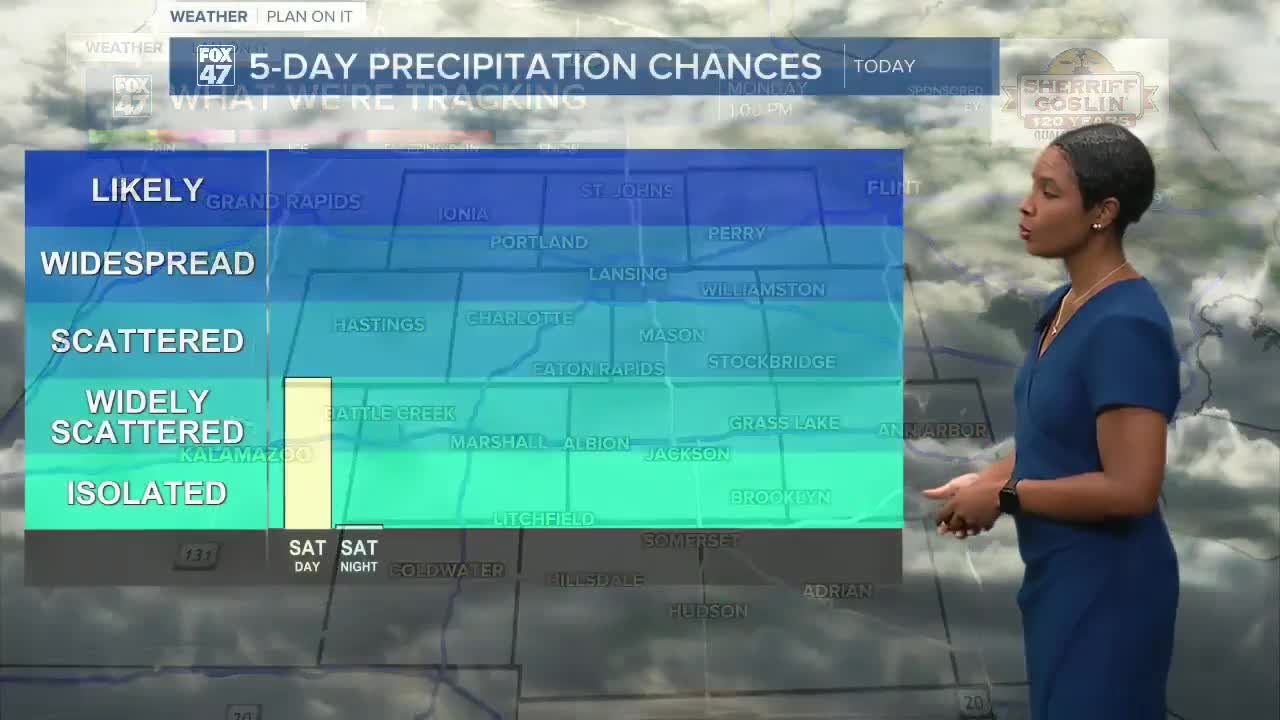
Pleasant Saturday Ahead
Once any early morning showers exit, Saturday should feature a mix of sun and clouds with comfortable temperatures.
An isolated afternoon or evening thunderstorm cannot be ruled out, but many communities will remain dry.
High temperatures will climb into the middle 70s, which is right where they'll remain for much of the upcoming week.
Father's Day Looks Warm, Storm Chance Arrives Late
Father's Day is expected to be a pleasant day overall, with highs reaching the mid-70s.
While much of the daylight hours may stay dry, clouds will increase late in the day as a developing storm system approaches from the Midwest.
The better chance for rain arrives Sunday night.
Heavy Rain Potential Sunday Night Into Monday
The most impactful weather event in the forecast appears to be Sunday night through Monday.
Forecast models continue to show a strengthening low-pressure system tracking across the Midwest and into the Great Lakes. Recent guidance has shifted the storm track slightly farther north, increasing confidence in widespread rainfall across Mid-Michigan.
Current projections suggest:
- 0.75 to 1 inch of rain possible along the I-96 corridor
- 1 to 1.5 inches of rain possible along and south of I-94
- Locally higher totals cannot be ruled out
Forecasters are also monitoring unusually high moisture levels associated with the system, which could support periods of heavy rainfall.
The Weather Prediction Center has highlighted areas along and south of I-94 for a Slight Risk of Excessive Rainfall, meaning localized flooding issues could develop where heavier bands of rain persist.
Fortunately, severe weather is not expected to be a major concern. Atmospheric instability and wind shear remain limited, although a few embedded rumbles of thunder are possible.
Brief Break Before More Rain Returns
The storm system will gradually move east Monday, allowing conditions to improve for a time.
Tuesday currently looks to be the driest day of the upcoming work week, featuring partly sunny skies and temperatures in the mid-70s.
However, the overall weather pattern remains unsettled. Another upper-level system is expected to drop into the Great Lakes by the middle of next week, bringing additional opportunities for showers and thunderstorms Wednesday into Thursday.
Temperatures Stay Comfortable
Unlike many late June weather patterns that bring prolonged heat and humidity, this setup favors continued northwest flow across the Great Lakes.
As a result, temperatures are expected to stay 5 to 10 degrees below average, with highs generally ranging from the mid-70s throughout the seven-day forecast.
FOX 47 Super 7-Day Forecast
Saturday: Partly sunny with an isolated thunderstorm possible. High 75°, Low 54°.
Father's Day Sunday: Warm with increasing clouds and a chance of late-day thunderstorms. High 76°, Low 56°.
Monday: Showers likely, especially during the morning and afternoon. Heavy rainfall possible. High 74°, Low 52°.
Tuesday: Partly sunny and drier. High 76°, Low 55°.
Wednesday: Chance of thunderstorms returns. High 75°, Low 55°.
Thursday: Chance of showers with scattered thunderstorms possible. High 76°, Low 55°.
Friday: Mostly sunny and pleasant. High 77°, Low 55°.
Bottom Line
The weekend starts fairly quiet with comfortable temperatures and only isolated rain chances. The forecast turns wetter Sunday night into Monday, when a soaking rain of 1 inch or more may fall across portions of Mid-Michigan. After a brief dry period Tuesday, additional chances for showers and storms return during the second half of next week, while temperatures remain comfortably in the 70s.
Have a great weather picture or video to share? Send it our way and we may feature it on-air or online!

