
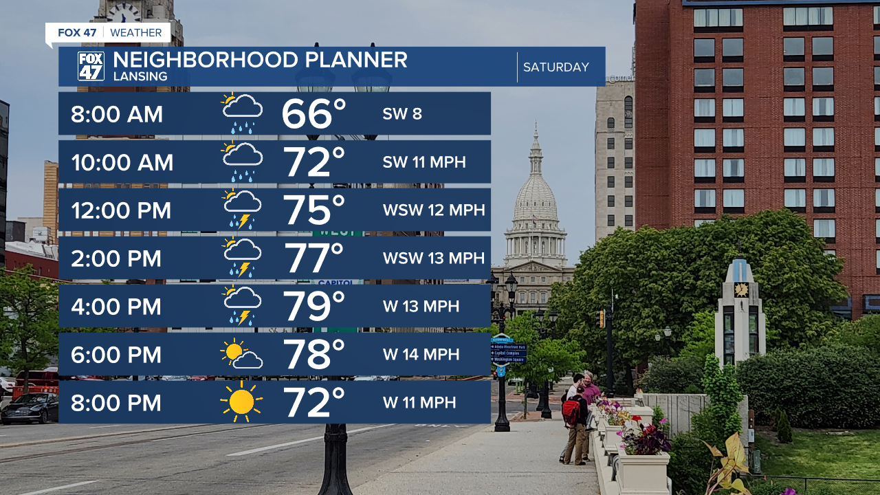
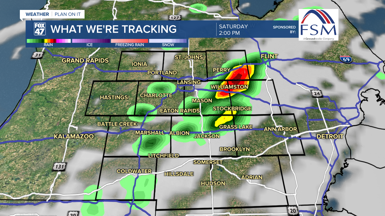
Saturday kicks off with mostly cloudy skies and possibly a few morning showers. This will be followed by hit-or-miss thunderstorms starting around midday, and continuing through 5:00 PM. The day won't be a washout, but keep an eye on the sky if you have plans to be outdoors. Highs will top the low 80s one more time, then we go on a stretch of much more Fall-like weather into much of next week.
Partly to mostly cloudy skies take over on Sunday, as a wave of unseasonably cool air begins to settle in from the northwest. A few spotty showers will be possible, but the majority of our neighborhoods will stay dry. Highs will be held to the mid 70s for the second half of the weekend, with lows Sunday night set to dive into the low 50s.
GET YOUR FOX 47 FORECAST HERE
The chance for a few showers continues on Monday as an upper-level lows moves through the Great Lakes. The added cloud cover and northwesterly winds associated with it will keep highs in the upper 60s, well below the average upper 70s we should be seeing in the final days of August.

We dry out again as we move into the midweek period, with unseasonably cool conditions remaining in place. Highs Tuesday and Wednesday will stay in the low to mid 70s, with a round of lows in the 40s coming our way on Tuesday night.
Want more FOX 47 News? Here's how you download our Roku app
You can also see the latest news from across our mid-Michigan neighborhoods by liking us on Facebook or following us on X.
