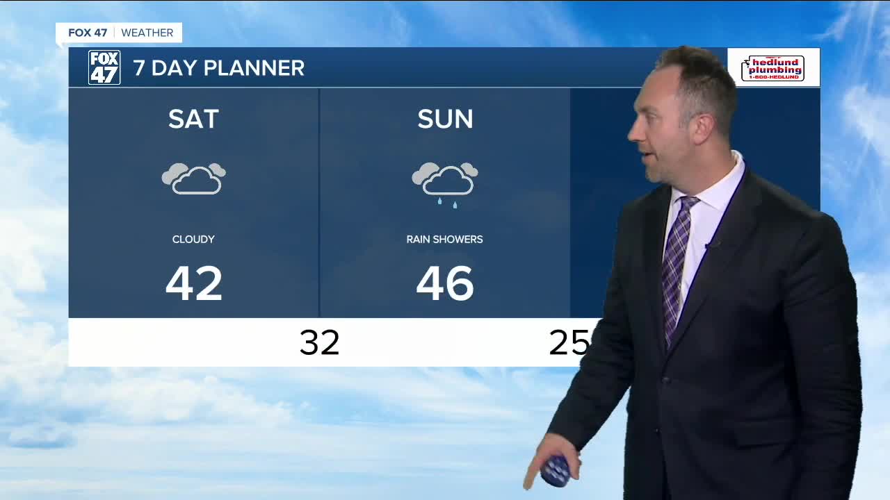


MID-MICHIGAN — Happy weekend, everyone! Mostly cloudy skies continue today, with high temperatures returning to the lower 40s. Our next rain chance arrives on Sunday, with precipitation changing over to lake-effect snow by late Sunday into Monday. Light accumulations are possible, with lake effect snow bands dropping potentially 1" or less of snowfall. The overall quiet, but chilly weather looks to carry into Thanksgiving week as well. If you are traveling for the holiday, rain chances are back in our forecast for Wednesday. Thanksgiving Day can see some minor snowfall. Check for updates closer to the holiday.
TODAY: Partly cloudy to mostly cloudy skies. Highs in the lower 40s. South / southwesterly wind at 10 to 15 mph, with wind gusts up to 25 mph
SUNDAY: Mostly cloudy with rain showers likely. Switching over to lake effect snow overnight. Highs in the upper 40s. South / southwest wind at 5 to 15 mph, with wind gusts up to 20 mph.
MONDAY: Mostly cloudy with the chance for snow showers. Light accumulations possible. Highs in the lower 30s. Strong northwest wind at 10 to 20 mph, with wind gusts up to 30 mph. Wind chill temperatures or "feels like" temperatures will be in the teens.
TUESDAY: Partly cloudy. Highs in the upper 30s.
WEDNESDAY: Mostly cloudy with a chance of rain showers. Highs in the lower 40s.
THANKSGIVING: Mostly cloudy with the chance of snow showers. Highs near 40 degrees.
Want to learn more about the Weather? Visit the FOX47News Website.
Stay in touch with us anytime, anywhere.
Sign up for newsletters emailed to your inbox.
Select from these options: Breaking News, Severe Weather, School Closings, Daily Headlines and Daily Forecasts.
