LANSING, Mich. — Memorial Day brought a lot of sunshine and warmth to our neighborhoods with Lansing seeing high temps in the lower 70's. We will continue this trend today, but without the abundance of sunshine.
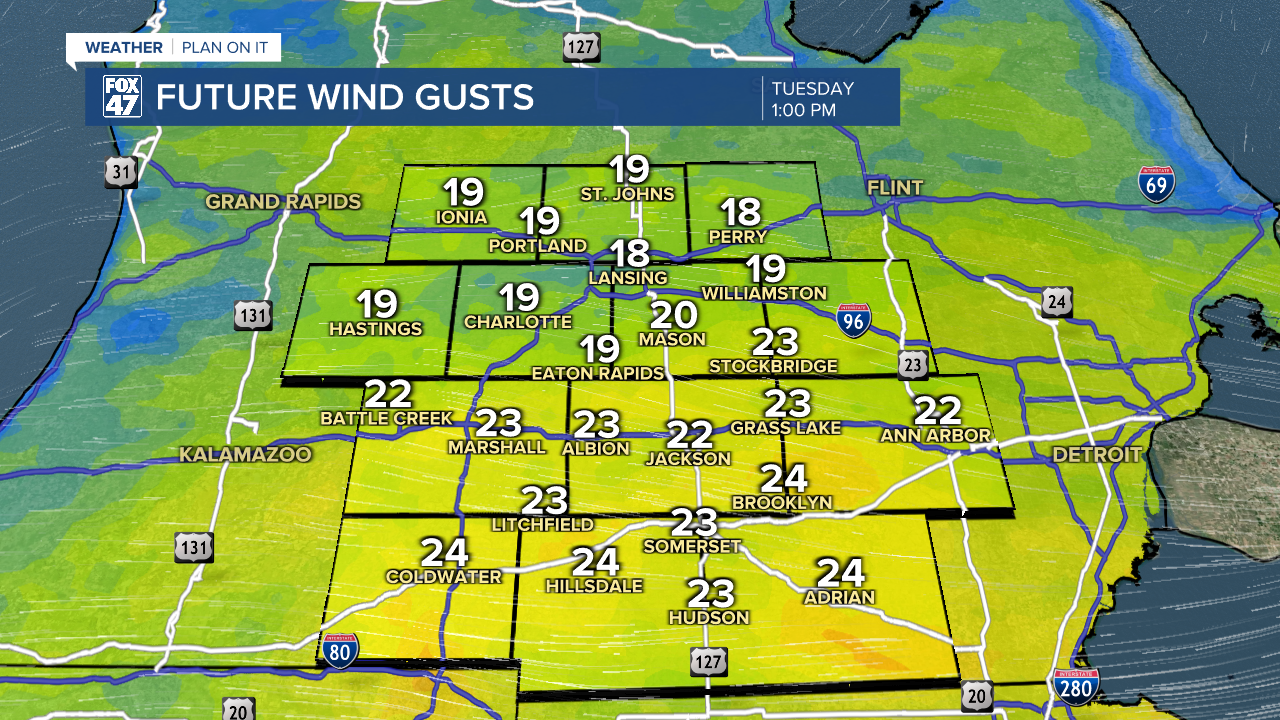
Mostly cloudy skies are expected across our neighborhoods today with high temps in the lower 70's. Winds out of the east could gust up to 25 mph today as surface high pressure tracks northeast of Michigan.
WATCH THE FULL FORECAST BELOW
These dry conditions will be taking a break midweek as showers return to the area. An area of low pressure will track north into Michigan on Wednesday which will drive uniform areas of showers.

Showers will start as early as 2 PM on Wednesday and last through 11 PM Wednesday. We are not expecting any severe impacts affiliated with these showers, but we could see some heavier rainfall rates during this time period. Make sure to pack the rain gear.
showers won't stop there as the area of low pressure tracks through Michigan, light remnant showers are possible on Thursday. These showers won't carry any major impacts.
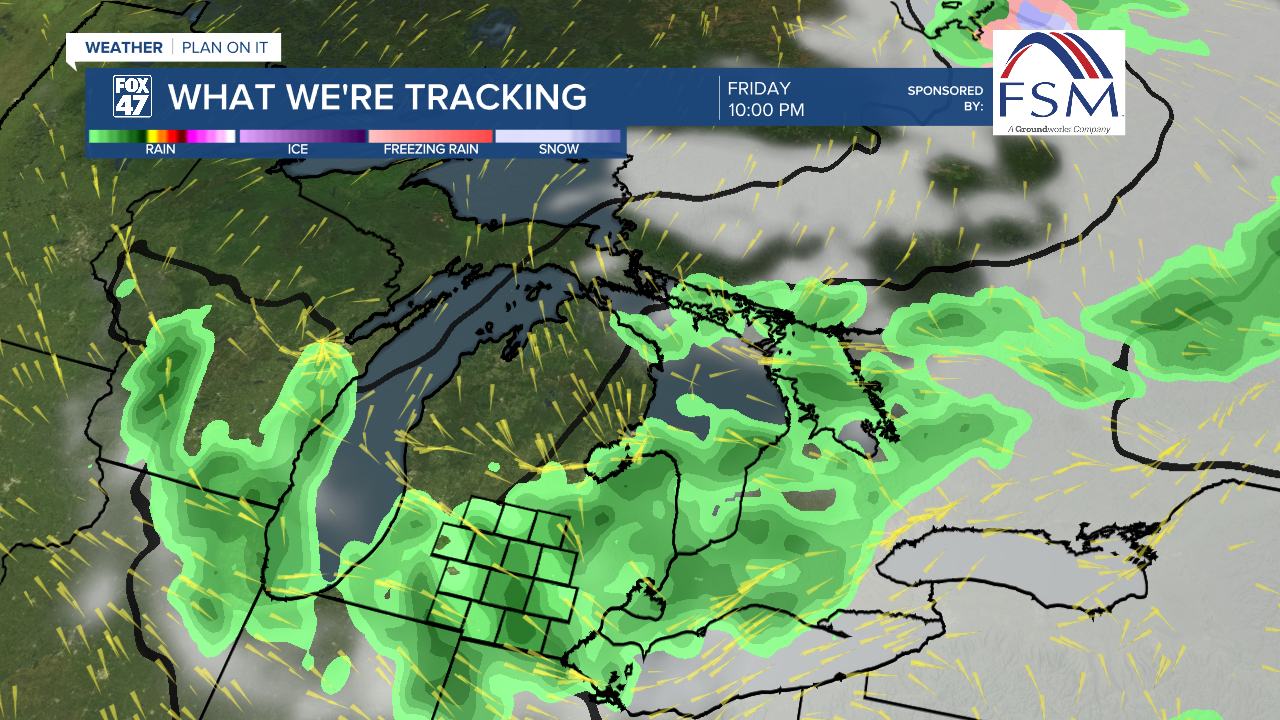
Another round of showers will advance through our neighborhoods ahead of a cold front on Friday. Again, we are not expecting any severe impacts with these showers, but we could hear some rumbles of thunder with present instability in the atmosphere. We will be watching very closely.
We will be drying up as we enter the weekend as high temperatures will return to the lower 70's following a brief dip during the midweek showers.

Want to learn more about the Weather? Visit the FOX47News Website.
Stay in touch with us anytime, anywhere.
Sign up for newsletters emailed to your inbox.
Select from these options: Breaking News, Severe Weather, School Closings, Daily Headlines and Daily Forecasts.
