
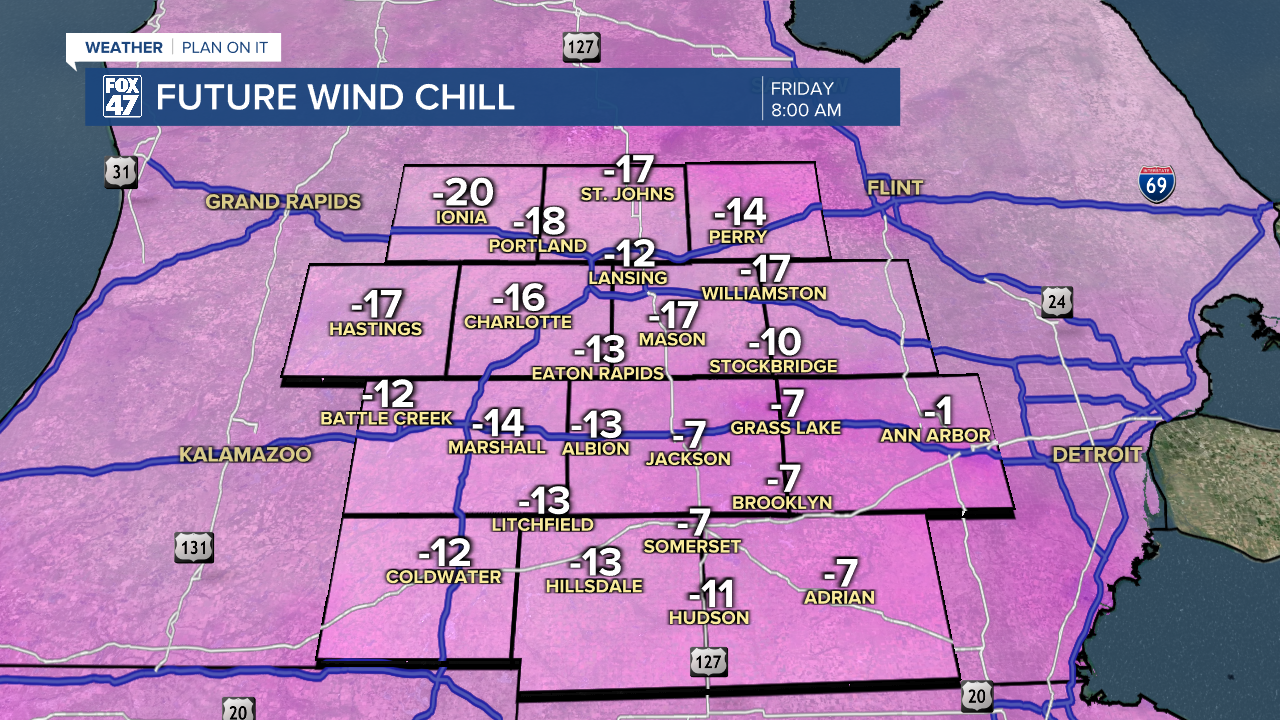
COLD WEATHER ADVISORY in effect from 12:00 AM to 10:00 AM Friday for the following counties: BARRY, CALHOUN, CLINTON, EATON, INGHAM, IONIA, JACKSON, LIVINGSTON, SHIAWASSEE. Wind chills between -15° to -20° are possible overnight into Friday morning. Frostbite will be possible on exposed skin in as little as 30 minutes.

Cloudy skies this evening are expected to gradually give way to clearing overnight as light winds pivot toward the northeast. This will push most of the clouds south and west of the region by daybreak. Lows will fall below zero where skies clear, while cloudier areas will likely see lows hold in the low single-digits. Even with light northwesterly winds at 3-6 mph, this could push wind chills into the negative teens.
Our weather stays on a quiet course Friday through Sunday as a region of high pressure expands across the central and eastern United States. While this will lead to more sunshine and keeps snow showers out of the picture, it won't do anything to warm us up at first. Highs Friday and Saturday will remain in the low to middle teens, with lows below zero again both nights.
GET YOUR FOX 47 FORECAST HERE
We start to turn a corner into slightly milder weather starting on Sunday, though. Highs will return to the low 20s for the first time in 10 days, and we'll remain on a stretch of highs in the low to mid 20s for the majority of next week. Snow showers return with a new disturbance on Monday for Groundhog Day, followed by another chance on Wednesday.

Want more FOX 47 News? Here's how you download our Roku app
You can also see the latest news from across our mid-Michigan neighborhoods by liking us on Facebook or following us on X.
