
LANSING, Mich. — It has been another wild roller coaster ride for us over the past couple of days. Sunday's warmer 60s, showers and thunderstorms gave way to biting cold, windy conditions and snow showers on Monday.
That cold will dig in further tonight as winds ease slightly. Scattered snow showers are expected to continue on and off, with lows heading for the mid teens by daybreak. Winds will drop below advisory levels, but will continue out of the WNW at 10-15 mph, with gusts between 30-40 mph possible. This will force wind chills into the single-digits, and possibly near-zero going into Tuesday morning.
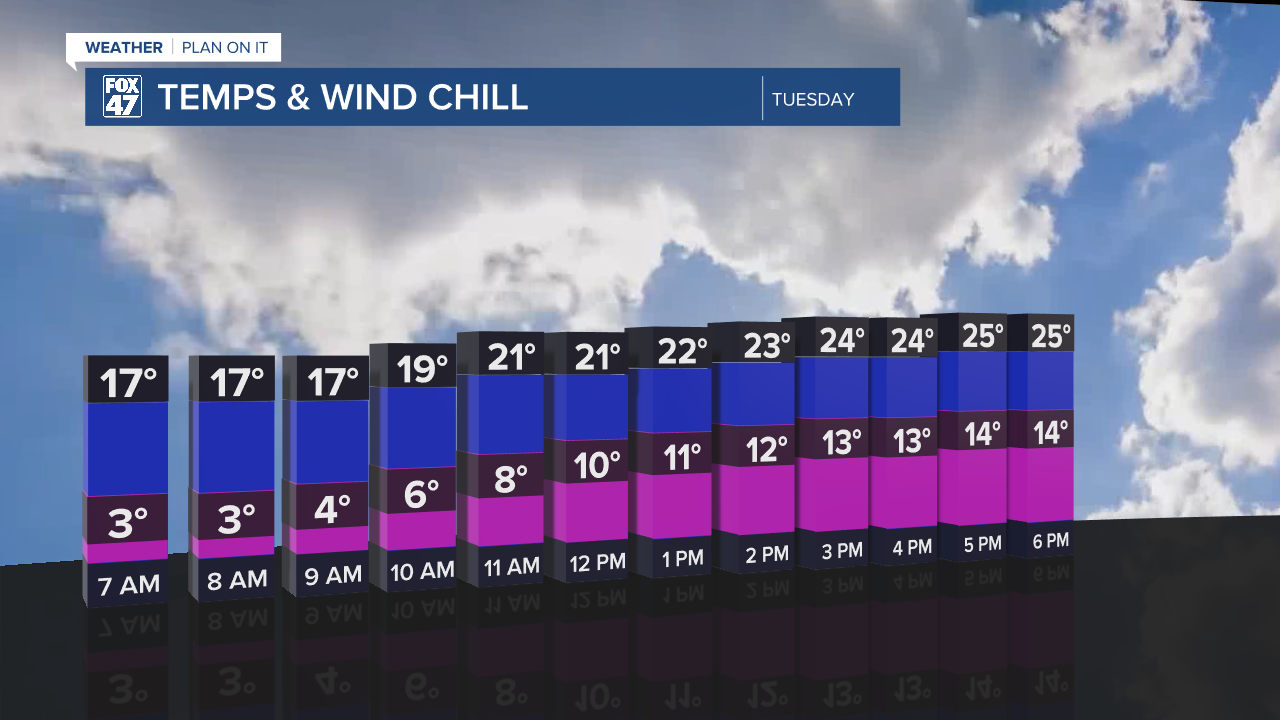
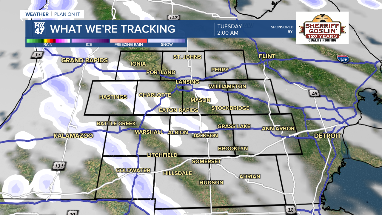
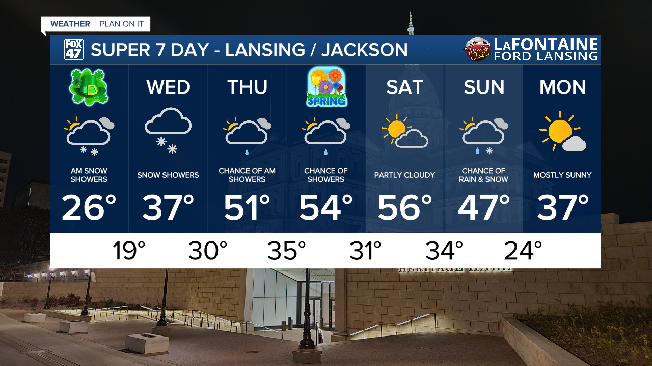
This sets up a bitterly cold St. Patrick's Day for us on Tuesday. Scattered snow showers will continue to make for some travel headaches on the morning commute, but will taper off after midday. Wind chills hovering in the single-digits in the morning will climb to the middle teens at best as highs only top out in the mid 20s. That's close to 20 degrees below average for mid-March.
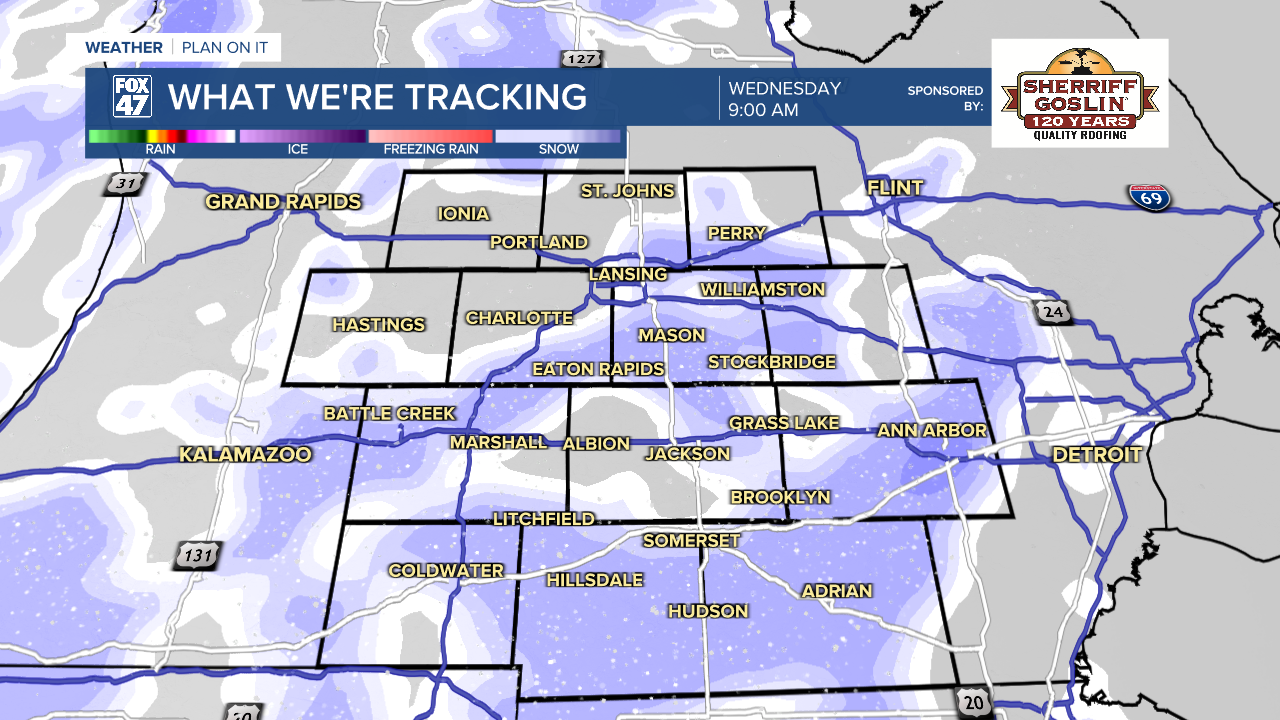
We begin a trend back toward milder temperatures on Wednesday, but it won't be enough to prevent snow showers from returning with a new disturbance. Highs will return to the middle and upper 30s, but a deep pool of cold air aloft should prevent any significant mixing from taking over. Snow accumulation of less than half of an inch is possible.
GET YOUR FOX 47 FORECAST HERE
We get better boost in temperatures on Thursday thanks to increasing southwesterly flow. A brief wave of showers in the morning will give way to mostly cloudy skies in the afternoon with highs returning to the low 50s. Spring officially arrives at 10:46 AM Friday, and we'll keep it mild with highs holding in the mid 50s. A few showers will be possible, but Friday is shaping up to be a good day to get outside.
Want more FOX 47 News? Here's how you download our Roku app
You can also see the latest news from across our mid-Michigan neighborhoods by liking us on Facebook or following us on X.
