
LANSING, Mich. — Sunday:
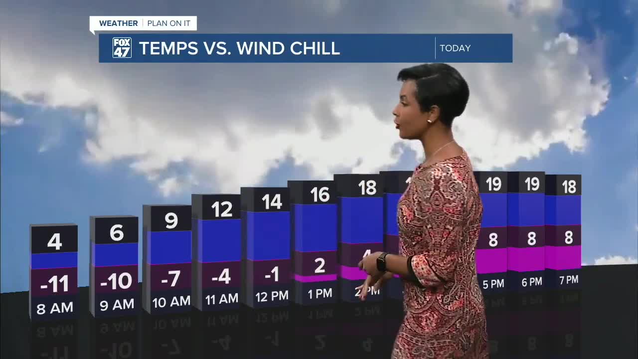
If you are heading out the door early in the morning, the actual temperature will be about 4°F at 8:00 a.m., but it will only feel like -11! Please dress warmly and limit time outdoors to avoid frostbite. Partly cloudy, with a chance of an isolated snow shower, mainly near Perry and Williamston. Highs only reach about 20°F. Lows drop back near 9°F Sunday night, and feel like temperatures will be well below zero again.
Monday:
Similar story. Cold, quiet, and winter firmly in place. Scattered snow showers are expected to move through very early, then mostly cloudy conditions will prevail. Temperatures are still bitterly cold, only topping out around 19°F. With winds gusting in the upper 30s and low 40s at times, it's going to feel very cold!
Next Week – Warming Trend:
Temperatures climb above freezing by Tuesday-Thursday, which will feel like a break after several really cold days. However, there is a catch. A low-pressure system will move through Wednesday night-Thursday, bringing rain at times, along with freezing rain or a wintry mix as temps drop at night.
Friday:
The temperatures drop back down to just about 27°F after this system exits, but rebound to the mid-30s for Saturday.
Want more FOX 47 News? Here's how you download our Roku app
You can also see the latest news from across our mid-Michigan neighborhoods by liking us on Facebook or following us on X.
