
LANSING, Mich. — Isolated thunderstorms remain possible this evening as a cold front sweeps across Michigan, but the bulk of the energy available for storms was spent earlier this afternoon. Any additional storms that do develop this evening through early Tuesday will be brief, and fairly light, not expected to cause any issues. Humidity levels will begin to come down overnight in the wake of the cold front, as lows dip to the mid 60s.
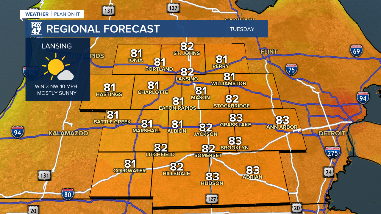
We begin July and the second half of 2025 on a pleasant note on Tuesday. A few leftover showers in the morning will quickly give way to mostly sunny skies. Highs will scale back to comfortably warm levels in the low 80s, and we'll cut the high humidity out of the equation. Add in a westerly breeze at 5-15 mph, and it it will be a perfect day to get outside. We'll keep similar conditions around for Wednesday and Thursday, too.
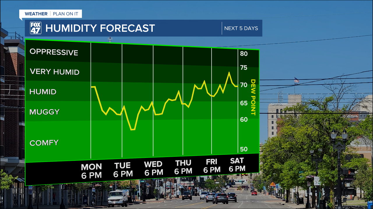
Temperatures and humidity begin to trend upward again on Friday for Independence Day, but we're still looking at a pleasant holiday. If you're kicking the weekend off with barbecues, fireworks, or a trip to the lake, the weather is not expected to get in the way. Highs will top the upper 80s, with heat indices tipping over into the low 90s.
GET YOUR FOX 47 FORECAST HERE
The heat and humidity will really settle in on Saturday and Sunday. Highs will top the low 90s on Saturday, with upper 80s expected on Sunday. This will push heat indices into the mid 90s both days, so you'll need to stay hydrated for your holiday weekend plans. Keep an eye on the sky as well, as the returning heat and humidity will fuel pop-up showers and thunderstorms.

Want to learn more about the Weather? Visit the FOX47News Website.
Stay in touch with us anytime, anywhere.
Sign up for newsletters emailed to your inbox.
Select from these options: Breaking News, Severe Weather, School Closings, Daily Headlines and Daily Forecasts.
