
LANSING, Mich. — A late wave of lake effect snow showers impacting northern neighborhoods will come to an end this evening as winds begin to diminish. Additional accumulation beyond a dusting is not expected, but expect roads to be slick through the first half of the evening. Clouds will decrease overnight, with lows taking a dive toward the low and middle teens. With winds backing off, significant wind chills are not expected.
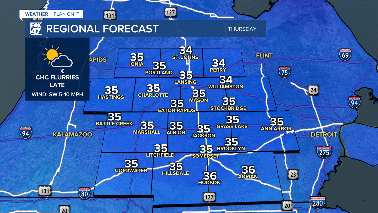
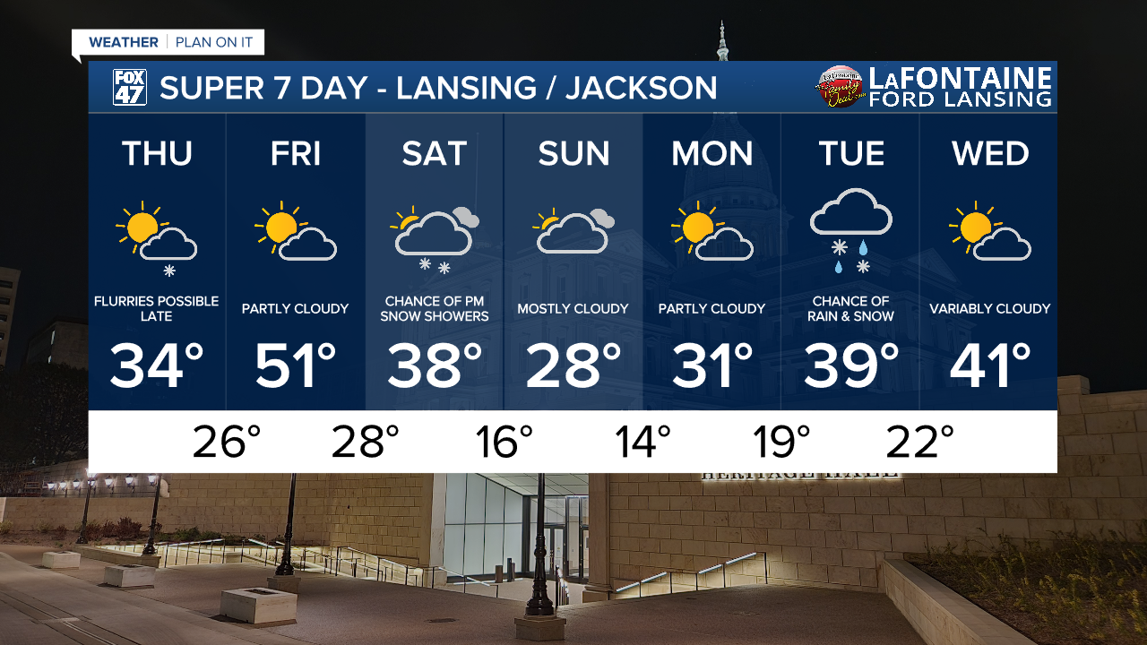
Thursday is looking a bit sunnier as a pocket of high pressure moves in from the Upper Midwest. We'll look for partly cloudy skies throughout the day, with just a small chance for a few flurries in the evening as a small disturbance sweeps through the Great Lakes. Highs will inch a little higher to the mid 30s, with light southwesterly winds at 5-10 mph. A few additional flurries will be possible Thursday night as the disturbance continues across the region, but no significant snow accumulation is expected.

Friday remains the bright spot of the week. Partly cloudy skies will remain in place with highs taking a brief leap back into Spring. We're now looking at highs reaching the low 50s with an increasing SSW breeze at 10-15 mph. Get outside and soak it up while you can because we'll flip right back into Winter over the weekend.
GET YOUR FOX 47 FORECAST HERE
Saturday brings clouds back to our neighborhoods, with the potential for a few snow showers later in the afternoon. Highs will start the day in the upper 30s, and gradually fall throughout the day. We'll follow it up with highs in the 20s for Sunday, but we'll stay dry under mostly cloudy skies.
Want more FOX 47 News? Here's how you download our Roku app
You can also see the latest news from across our mid-Michigan neighborhoods by liking us on Facebook or following us on X.
